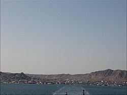
Türkmenbaşy, Turkmenistan
|
Türkmenbaşy Түркменбашы |
|
|---|---|

Türkmenbaşy
|
|
| Location in Turkmenistan | |
| Coordinates: 40°01′00″N 52°58′00″E / 40.01667°N 52.96667°E | |
| Country |
|
| Province | Balkan |
| Elevation | 27 m (89 ft) |
| Population (2010) | |
| • Total | 73 000 |
| Time zone | UTC+5 |
| Area code(s) | 993 243 XXXXX |
Türkmenbaşy (Turkmen Cyrillic: Түркменбашы; also spelled Turkmenbashi, Түркменбаши), formerly known as Krasnovodsk (Russian: Красноводск) and Kyzyl-Su, is a city in Balkan Province in Turkmenistan, on the Krasnovodsk Gulf of the Caspian Sea. It sits at an elevation of 27 metres (89 feet). The population (est 2004) was 86,800, mostly ethnic Russian, Armenians and Azeri. As the terminus of the Trans-Caspian Railway, it was an important transportation center.
In 1717, Russian Prince Alexander Bekovich-Cherkassky landed and established a secret fortified settlement on this location, where the dry bed of a former mouth of the Amu-Darya River once emptied into the Caspian Sea. His intent was to march an army up this dry riverbed and conquer the Khanate of Khiva. The expedition failed, and the Russians abandoned the settlement for over 150 years.
In 1869, the Russians invaded a second time. They named their fort Krasnovodsk (Красноводск), which is the Russian version of the original name, Kyzyl-Su (Red Water). Krasnovodsk was Imperial Russia's base of operations against Khiva and Bukhara, and the nomadic Turkmen tribes.
The railway had originally begun from Uzun-Ada on the Caspian Sea, but the terminus was shifted north to the harbour at Krasnovodsk.
It fell to the Red Army in February, 1920.
...
Wikipedia

