Tönningen
| Tönning Tønning / Taning |
||
|---|---|---|

Skippers house
|
||
|
||
| Coordinates: 54°19′2″N 8°56′34″E / 54.31722°N 8.94278°ECoordinates: 54°19′2″N 8°56′34″E / 54.31722°N 8.94278°E | ||
| Country | Germany | |
| State | Schleswig-Holstein | |
| District | Nordfriesland | |
| Government | ||
| • Mayor | Dorothe Klömmer | |
| Area | ||
| • Total | 44.41 km2 (17.15 sq mi) | |
| Elevation | 0 m (0 ft) | |
| Population (2015-12-31) | ||
| • Total | 4,895 | |
| • Density | 110/km2 (290/sq mi) | |
| Time zone | CET/CEST (UTC+1/+2) | |
| Postal codes | 25832 | |
| Dialling codes | 04861 | |
| Vehicle registration | NF | |
| Website | www.toenning.de | |
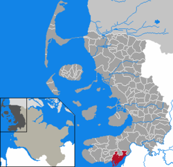
Tönning (German; Low German Tünn, Tönn or Tönnen; Danish: Tønning; North Frisian: Taning) is a town in the district of Nordfriesland in the German state of Schleswig-Holstein.
Tönning was destroyed in the Burchardi flood in 1634. During the Great Northern War, (1700–1721), Tönning was besieged twice.
It lies on the Eider river near its mouth at the North Sea. Tönning has a population of approximately 5,000.
...
Wikipedia


