Syracuse, Utah
| Syracuse, Utah | |
|---|---|
| City | |

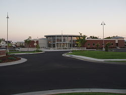
Syracuse City Municipal Center
|
|
| Motto: Provide quality affordable services while promoting community pride, fostering economic development and managing growth. | |
 Location in Davis County and the state of Utah |
|
| Coordinates: 41°5′3″N 112°3′48″W / 41.08417°N 112.06333°WCoordinates: 41°5′3″N 112°3′48″W / 41.08417°N 112.06333°W | |
| Country | United States |
| State | Utah |
| County | Davis |
| Settled | 1878 |
| Incorporated | September 3, 1935 |
| City | September 13, 1950 |
| Named for | Syracuse, New York |
| Government | |
| • Type | Mayor-council government |
| • Mayor | Terry Palmer |
| Area | |
| • Total | 9.58 sq mi (24.80 km2) |
| • Land | 9.57 sq mi (24.79 km2) |
| • Water | 0.008 sq mi (0.02 km2) |
| Elevation | 4,285 ft (1,306 m) |
| Population (2010) | |
| • Total | 24,331 |
| • Estimate (2014) | 26,639 |
| • Density | 2,784/sq mi (1,074.8/km2) |
| Time zone | Mountain (MST) (UTC-7) |
| • Summer (DST) | MDT (UTC-6) |
| ZIP code | 84075 |
| Area code(s) | 385, 801 |
| FIPS code | 49-74810 |
| GNIS feature ID | 1433147 |
| Website | www |
Syracuse is a city in Davis County, Utah, United States, between the Great Salt Lake and Interstate 15, about 30 miles (48 km) north of Salt Lake City. It is part of the Ogden–Clearfield, Utah Metropolitan Statistical Area. The population was 24,331 at the 2010 census, an increase of 158.9% since the 2000 census. The city has seen rapid growth and development since the 1990s.
Syracuse was incorporated on September 3, 1935.
The city is located in northern Davis County on the eastern side of the Great Salt Lake. It is bordered to the north by West Point, to the northeast and east by Clearfield, and to the southeast by Layton.
According to the United States Census Bureau, Syracuse has a total area of 9.6 square miles (24.8 km2), of which 0.01 square miles (0.015 km2), or 0.06%, is water.
As of the census of 2010, there were 24,331 (2010) people, and 6,362 (2010) households residing in the city. The population density was 2,793.46 (2010) people per square mile (1,736.69/km² (2010)). There were 6,534 (2010) housing units at an average density of 298.6 (2010) per square mile (115.3/km² (2010)). The racial makeup of the city was 94.6% (2010) White, 2.9% (2010) Asian, 1.2% (2010) African American, 0.7% (2010) Native American, 0.6% (2010) Pacific Islander, 2.7% (2010) from other races. Hispanic or Latino of any race were 6% (2010) of the population.
...
Wikipedia
