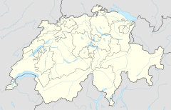
Swiss Tectonic Arena Sardona
 |
|
| UNESCO World Heritage Site | |
|---|---|
| Location |
Graubünden, Switzerland |
| Coordinates | 46°55′00″N 9°15′00″E / 46.9167°N 9.25°E |
| Criteria | Natural: (viii) |
| Reference | 1179 |
| Inscription | 2008 (32nd Session) |
| Website | www |
|
[]
|
|
The Glarus thrust (German: Glarner Überschiebung) is a major thrust fault in the Alps of eastern Switzerland. Along the thrust the Helvetic nappes were thrusted more than 100 km to the north over the external Aarmassif and Infrahelvetic complex. The thrust forms the contact between older (Helvetic) Permo-Triassic rock layers of the Verrucano group and younger (external) Jurassic and Cretaceous limestones and Paleogene flysch and molasse.
The Glarus thrust crops out over a relatively large area in the cantons Glarus, St. Gallen and Graubünden, due to its horizontal orientation and the high local relief. Famous outcrops include those at Lochsite near Glarus (the town) and in a mountain cliff called Tschingelhörner between Elm and Flims (in the same cliff is a natural hole called the Martinsloch).
Thrust faults of this kind are not uncommon in many mountain chains around the world, but the Glarus thrust is a well accessible example and has as such played an important role in the development of geological knowledge on mountain building. For this reason the area in which the thrust is found was declared a geotope, a geologic UNESCO world heritage site, under the name "Swiss Tectonic Arena Sardona." The area of this "tectonic arena" encompasses 32,850 hectares of mainly mountainous landscape in 19 communities between the Surselva, Linthtal and Walensee. In the arena are a number of peaks higher than 3000 meters, such as Surenstock (its Romansh name is Piz Sardona, from which the name comes), Ringelspitz and Pizol.
...
Wikipedia

