Swartberg
| Swartberg | |
|---|---|

Swartberg pass
|
|
| Highest point | |
| Peak | Seweweekspoortpiek |
| Elevation | 2,325 m (7,628 ft) |
| Listing | List of mountain ranges of South Africa |
| Coordinates | 33°22′0″S 22°21′15″E / 33.36667°S 22.35417°ECoordinates: 33°22′0″S 22°21′15″E / 33.36667°S 22.35417°E |
| Dimensions | |
| Length | 230 km (140 mi) ESE/WNW |
| Width | 70 km (43 mi) NNE/SSW |
| Geography | |
| Country | South Africa |
| Province | Western Cape |
| Geology | |
| Orogeny | Cape Fold Belt |
| Age of rock | Carboniferous and Permian |
| Type of rock | Quartzitic sandstone |
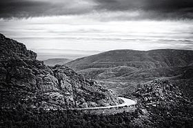
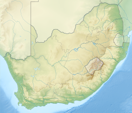
The Swartberg mountains (black mountain in Afrikaans) are a mountain range in the Western Cape province of South Africa. It is composed of two main mountain chains running roughly east-west along the northern edge of the semi-arid Little Karoo. To the north of the range lies the other large semi-arid area in South Africa, the Great Karoo. Most of the Swartberg Mountains are above 2000 m high, making them the tallest mountains in the Western Cape. It is also one of the longest, spanning some 230 km from south of Laingsburg in the west to between Willowmore and Uniondale in the east. Geologically, these mountains are part of the Cape Fold Belt.
Much of the Swartberg is part of a UNESCO World Heritage Site.
The Swartberg consists of two officially named ranges, the Smaller and the Greater Swartberg Mountains.
The Smaller Swartberg are the westernmost of the two. Ironically, this range is the higher one, including the province's highest peak, Seweweekspoortpiek (Seven Weeks Gorge Peak) at 2325 m. The famous Towerkop (Bewitch Peak) towers over the Klein Karoo town of Ladismith at a height of 2189 m. The peak is so named for its cleft peak, that, according to legend, was split by a spell and subsequent bolt of lightning.
The Greater Swartberg is located to the east, with the dividing line between the two ranges being the Gouritz River, which cuts a gorge directly through the range. This section, almost of a similar height, is slightly lower in elevation, with the Tierberg (Leopard Mountain) at 2132 m being the highest. These mountains are home to the Cango Caves in the exposed limestone basement rocks exposed by upliftment along a 300 km fault line that runs along the southern flank of the Swartberg ranges (see diagram on the left). These are the most famous subterranean system in South Africa, located just north of Oudtshoorn.
...
Wikipedia

