Sveio
| Sveio kommune | |||
|---|---|---|---|
| Municipality | |||

View of the Ryvarden coastline in Sveio
|
|||
|
|||
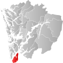
 Sveio within Hordaland |
|||
| Coordinates: 59°34′25″N 05°21′48″E / 59.57361°N 5.36333°ECoordinates: 59°34′25″N 05°21′48″E / 59.57361°N 5.36333°E | |||
| Country | Norway | ||
| County | Hordaland | ||
| District | Haugalandet | ||
| Administrative centre | Sveio | ||
| Government | |||
| • Mayor (2011) | Ruth Grethe Eriksen (H) | ||
| Area | |||
| • Total | 246.14 km2 (95.04 sq mi) | ||
| • Land | 224.25 km2 (86.58 sq mi) | ||
| • Water | 21.89 km2 (8.45 sq mi) | ||
| Area rank | 309 in Norway | ||
| Population (2015) | |||
| • Total | 5,509 | ||
| • Rank | 190 in Norway | ||
| • Density | 24.6/km2 (64/sq mi) | ||
| • Change (10 years) | 17.9 % | ||
| Demonym(s) | Sveibu | ||
| Time zone | CET (UTC+1) | ||
| • Summer (DST) | CEST (UTC+2) | ||
| ISO 3166 code | NO-1216 | ||
| Official language form | Nynorsk | ||
| Website | www |
||
|
|
|||
Sveio is a municipality in Hordaland county, Norway. Sveio is a border district that is sometimes considered to be located in the traditional district of Haugalandet since it is located on the Haugalandet peninsula, but it is also considered to be in the traditional district of Sunnhordland since it is located in southern Hordaland county. The administrative centre of the municipality is the village of Sveio. Other villages in the municipality include Auklandshamn, Førde, Våga, and Valevåg.
Sveio is the site of the Ryvarden Lighthouse which marks the western entrance to the Hardangerfjorden. The lighthouse is automated and the old keepers house and building have now been converted into art galleries, the Flókemuseum, and a cafe. The composer Fartein Valen lived much of his life in Valevåg in northern Sveio. Valenheimen, the house he lived in is open to the public and the Fartein Valen Festival is held annually in Sveio.
The Triangle Link bridge-tunnel network is based in northern Sveio, connecting the islands to the north to the mainland. The southern entrance to the Bømlafjord Tunnel is located along the European route E39 highway, just south of the village of Valevåg.
The municipality of Sveio was established in 1865 when the part of Finnås municipality located south of the Bømlafjorden (population: 2,227) and the Vikebygd part of the municipality of Fjelberg (population: 1,062) were joined together as the new municipality of Sveen (later the spelling was changed to Sveio). On 1 January 1902, the Vikebygd area (population: 1,092) was separated from Sveio to form its own municipality. On 1 January 1964, there were some big municipal border changes in Norway due to the Schei Committee. Sveio (population: 1,697) was merged with the neighboring municipality of Valestrand (population: 1,216), the western half of the municipality of Vikebygd (population: 471), and a small part of the municipality of Skjold (population: 24). The part of Skjold was transferred from Rogaland county to Hordaland county on the same date.
...
Wikipedia


