Sutherland Industrial, Saskatoon
| Sutherland Industrial | |
|---|---|
| Neighbourhood | |

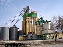
Co-Op Feeds plant
|
|
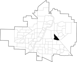
 Sutherland Industrial location map |
|
| Coordinates: 52°7′50″N 106°35′30″W / 52.13056°N 106.59167°WCoordinates: 52°7′50″N 106°35′30″W / 52.13056°N 106.59167°W | |
| Country |
|
| Province |
|
| City | Saskatoon |
| Suburban Development Area | University Heights |
| Neighbourhood | Sutherland Industrial |
| Settled | 1908 |
| Incorporated (town) | 1912 |
| Annexed | 1956 |
| Government | |
| • Type | Municipal (Ward 1) |
| • Administrative body | Saskatoon City Council |
| • Councillor | Darren Hill |
| Area | |
| • Total | 2.14 km2 (0.83 sq mi) |
| Population (2006) | |
| • Total | 10 |
| Time zone | UTC (UTC-6) |
Sutherland Industrial is an industrial subdivision located in east-central Saskatoon, Saskatchewan, Canada. It was originally part of Sutherland, a town outside of Saskatoon before being annexed by the city in 1956. The subdivision also contains the first urban reserve in Saskatchewan, the Muskeg Lake Cree Nation.
The land where Sutherland and Sutherland Industrial now sit was purchased in 1905 by Albert H. Hanson, a noted Saskatoon real estate agent. He sold part of his land to the Canadian Pacific Railway. The area was built up when the CPR branch line between Regina and Edmonton reached Saskatoon in 1907. The CPR yards and station were constructed three miles (5 km) east of Saskatoon. A settlement grew adjacent to the rail yards, and was incorporated as the village of Sutherland August 30, 1909. It was named after William Charles Sutherland, a politician who served on Saskatoon's town council before it became a city in 1906.
The triangular shape of the industrial subdivision came about as the two parts of Sutherland were developed. West of 1st (later Central) Avenue, Albert Hanson subdivided the rest of his land holdings on a north-south axis, and developed it as residential and commercial properties. On the other side of the tracks, the CPR subdivided its land following the rail axis on an angle from southeast to northwest. The resulting gap between Central Avenue and the tracks was built up as light industrial lands.
In 1956, the town was annexed by the growing city of Saskatoon. Sutherland became the city's easternmost neighbourhood until development in the 1970s took place even further east. The amalgamation required some name changes to Sutherland's streets, to avoid confusion with identically-named streets already in Saskatoon (e.g. 10th Street became 110th Street). At some point after annexation, the neighbourhood boundaries were redrawn. The mainly residential portion of the former town became the neighbourhood of Sutherland, while the rail yards and associated industrial lands were split off as the Sutherland Industrial subdivision. Development of the portion of Sutherland Industrial east of Central Avenue and north of what is now College Drive began in earnest in the early 1960s.
A small chunk of Sutherland Industrial was transferred to neighbouring Sutherland with the construction of several apartment buildings on Central Place. The Sutherland Branch of the Saskatoon Public Library was located within Sutherland Industrial for many years until a new facility was developed in the University Heights Suburban Centre in the 1990s.
...
Wikipedia
