Sunset, Montague County, Texas
| Sunset, Texas | |
|---|---|
| Unincorporated community | |
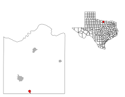
 Location of Sunset, Texas |
|
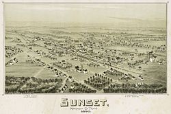
 Map of Sunset in 1890 |
|
| Coordinates: 33°27′14″N 97°46′0″W / 33.45389°N 97.76667°WCoordinates: 33°27′14″N 97°46′0″W / 33.45389°N 97.76667°W | |
| Country |
|
| State |
|
| County | Montague |
| Area | |
| • Total | 1.1 sq mi (2.8 km2) |
| • Land | 1.1 sq mi (2.8 km2) |
| • Water | 0.0 sq mi (0.0 km2) |
| Elevation | 991 ft (302 m) |
| Population (2000) | |
| • Total | 339 |
| • Density | 318.8/sq mi (123.1/km2) |
| Time zone | Central (CST) (UTC-6) |
| • Summer (DST) | CDT (UTC-5) |
| ZIP code | 76270 |
| Area code(s) | 940 |
| FIPS code | 48-71264 |
| GNIS feature ID | 1369410 |
Sunset is an unincorporated community in Montague County, Texas, United States. Until 1900, a surveying error had placed the community in Wise County. The Fort Worth and Denver Railway runs through Sunset. The population was 339 at the 2000 census. The city disincorporated on April 19, 2007.
On April 9, 2009, the community was evacuated in advance of approaching wildfires. The fires ripped through the town in "patchwork fashion," destroying many homes and businesses.
Sunset is located at 33°27′14″N 97°46′0″W / 33.45389°N 97.76667°W (33.453823, -97.766724). According to the United States Census Bureau, the city has a total area of 1.1 square miles (2.8 km2), all of it land.
As of the census of 2000, Sunset had 339 people, 133 households, and 90 families with a population density of 318.8 people per square mile (123.5/km²). Additionally, Sunset had 151 housing units at an average density of 142.0 per square mile (55.0/km²). The racial makeup was 95.28% White, 1.18% Asian, 1.47% from other races, and 2.06% from two or more races. Hispanic or Latino of any race were 3.24% of the population.
...
Wikipedia
