Sunndal
| Sunndal kommune | |||
|---|---|---|---|
| Municipality | |||
 |
|||
|
|||
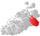
 Sunndal within Møre og Romsdal |
|||
| Coordinates: 62°36′46″N 8°38′3″E / 62.61278°N 8.63417°ECoordinates: 62°36′46″N 8°38′3″E / 62.61278°N 8.63417°E | |||
| Country | Norway | ||
| County | Møre og Romsdal | ||
| District | Nordmøre | ||
| Administrative centre | Sunndalsøra | ||
| Government | |||
| • Mayor (2009) | Ståle Refstie (Ap) | ||
| Area | |||
| • Total | 1,713.41 km2 (661.55 sq mi) | ||
| • Land | 1,647.90 km2 (636.26 sq mi) | ||
| • Water | 65.51 km2 (25.29 sq mi) | ||
| Area rank | 40 in Norway | ||
| Population (2010) | |||
| • Total | 7,205 | ||
| • Rank | 137 in Norway | ||
| • Density | 4.4/km2 (11/sq mi) | ||
| • Change (10 years) | -2.8 % | ||
| Demonym(s) | Sunndaling | ||
| Time zone | CET (UTC+1) | ||
| • Summer (DST) | CEST (UTC+2) | ||
| ISO 3166 code | NO-1563 | ||
| Official language form | Neutral | ||
| Website | www |
||
|
|
|||
![]() Sunndal is a municipality in the Nordmøre region located in the northeast part of Møre og Romsdal county, Norway. The administrative center of the municipality is the village of Sunndalsøra. Other villages include Gjøra, Grøa, Hoelsand, Jordalsgrenda, Romfo, Ålvund, Ålvundeidet, and Øksendalsøra.
Sunndal is a municipality in the Nordmøre region located in the northeast part of Møre og Romsdal county, Norway. The administrative center of the municipality is the village of Sunndalsøra. Other villages include Gjøra, Grøa, Hoelsand, Jordalsgrenda, Romfo, Ålvund, Ålvundeidet, and Øksendalsøra.
With an area of 1,712 square kilometres (661 sq mi), it is the largest municipality in Møre og Romsdal county. The important occupations in Sunndal include industry (with Hydro Aluminium Sunndal as the biggest employer), public services, retail, and farming.
Sunndal was established as a municipality on 1 January 1838 (see formannskapsdistrikt). The northern part of the municipality was separated in 1854 as the new municipality of Øksendal. On 1 January 1960, Ålvundeid (which was originally a part of Øksendal) and Øksendal were merged back into Sunndal. On 1 January 1965, the Ålvund-Ålvundfjord area of Stangvik (population: 508) was transferred to Sunndal.
...
Wikipedia


