Sunamganj Sadar Upazila
| Sunamganj (Sadar) সুনামগঞ্জ (সদর) |
|
|---|---|
 |
|
| Coordinates: 25°04′N 91°24′E / 25.067°N 91.400°E | |
| Division | Sylhet Division |
| District | Sunamganj District |
| Government | |
| • MPs (Sunamganj-3, Sunamganj-4) | Alhaj Motiur Rahman (4-AL), MA Mannan (3-AL) |
| Area | |
| • Total | 268.61 km2 (103.71 sq mi) |
| Population (2011) | |
| • Total | 279,019 |
| Time zone | BST (UTC+6) |
| Postal code | 3000 |
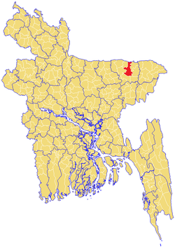
Sunamganj Sadar (Bengali: সুনামগঞ্জ সদর Sunamgonj Sodor) is an Upazila of Sunamganj District in the Division of Sylhet, Bangladesh.
Sunamganj Sadar is located at 25°04′N 91°24′E / 25.067°N 91.400°E. Geographically, it is situated on the northeastern part of Bangladesh. It has 50664 households and total area 268.61 km². It is the meeting place of three different upazilas. people are comaratively rich here and love fashion. Also It is placed near the bank of surma which is the longest river of Bangladesh. River with green fields make it as a spectacular view of picture from the born of it. In a word, the nature gives her full of beauty. This area is naturally full of mineral resources like natural gas, mineral oil, raw material for industries, crops, fish and so on. "Tanguar haowr" has been included the world heritage site which has thousand species of bird, fish, reptiles and so on are living together. Every year lots of tourist, researcher, nature lover etc. come to see this place from all area in Bangladesh as well as foreigner.
As of 1991[update] Bangladesh census, Sunamganj Sadar has a population of 303,153. Males constitute 51.27% of the population, and females 48.73%. This Upazila's eighteen up population is 153046. Sunamganj Sadar has an average literacy rate of 23.9% (7+ years), and the national average of 32.4% literate. Religions: Muslim 65%, Hindu 35%, Christian 2%, Buddhist 0.72%, and others 0.28%
...
Wikipedia
