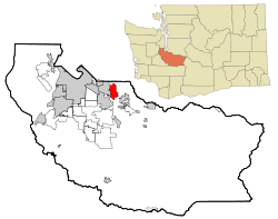
Sumner, Washington
| Sumner, Washington | |
|---|---|
| City | |
 Location of Sumner, Washington |
|
| Coordinates: 47°12′21″N 122°14′9″W / 47.20583°N 122.23583°WCoordinates: 47°12′21″N 122°14′9″W / 47.20583°N 122.23583°W | |
| Country | United States |
| State | Washington |
| County | Pierce |
| Area | |
| • Total | 7.62 sq mi (19.74 km2) |
| • Land | 7.51 sq mi (19.45 km2) |
| • Water | 0.11 sq mi (0.28 km2) |
| Elevation | 75 ft (23 m) |
| Population (2010) | |
| • Total | 9,451 |
| • Estimate (2015) | 9,700 |
| • Density | 1,258.5/sq mi (485.9/km2) |
| Time zone | Pacific (PST) (UTC-8) |
| • Summer (DST) | PDT (UTC-7) |
| ZIP codes | 98352, 98390 |
| Area code | 253 |
| FIPS code | 53-68435 |
| GNIS feature ID | 1512700 |
| Website | www.ci.sumner.wa.us |
Sumner is a city in northern Pierce County, Washington, United States. The population was 9,451 at the 2010 census. Nearby cities include Puyallup to the west, Auburn to the north, and Bonney Lake to the east.
Sumner was platted in 1883 by George H. Ryan, and was named for the 19th century U.S. Senator Charles Sumner.
Sumner is located at 47°12′21″N 122°14′9″W / 47.20583°N 122.23583°W (47.205823, -122.235803).
According to the United States Census Bureau, the city has a total area of 7.62 square miles (19.74 km2), of which, 7.51 square miles (19.45 km2) is land and 0.11 square miles (0.28 km2) is water.
After Orting, Sumner and Puyallup, are geographically next in line to be hit by lahars whenever Mount Rainier erupts in the future. This is depicted in the Modern Marvels episode titled "Most Dangerous," which shows a simulation of a lahar flooding the Orting and Puyallup Valleys from an eruption.
As of the census of 2010, there were 9,451 people, 3,980 households, and 2,454 families residing in the city. The population density was 1,258.5 inhabitants per square mile (485.9/km2). There were 4,279 housing units at an average density of 569.8 per square mile (220.0/km2). The racial makeup of the city was 87.3% White, 1.2% African American, 1.0% Native American, 2.4% Asian, 0.4% Pacific Islander, 3.4% from other races, and 4.3% from two or more races. Hispanic or Latino of any race were 10.1% of the population.
...
Wikipedia
