Sulitjelma (mountain)
| Sulitjelma | |
|---|---|
| Sulitelma, Sulidälbmá/Sulidælbmá | |

Sulitjelma seen from Padjelanta National Park
|
|
| Highest point | |
| Elevation | 1,908 m (6,260 ft) |
| Coordinates | 67°08′49″N 16°22′39″E / 67.14694°N 16.37750°ECoordinates: 67°08′49″N 16°22′39″E / 67.14694°N 16.37750°E |
| Geography | |
|
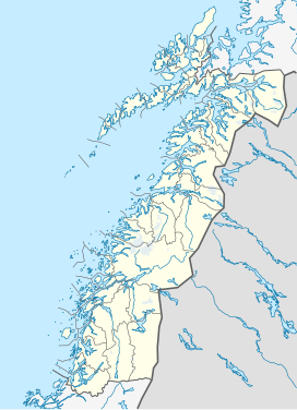
Location in Nordland
|
|
| Location |
Fauske, Nordland, Norway Arjeplog, Norrbotten, Sweden |
Sulitjelma (Swedish: Sulitelma, Pite Sami: Sulidälbmá/Sulidælbmá) is a mountain massif on the Norway-Sweden border in the municipality of Fauske in Nordland, Norway and the municipality of Arjeplog in Norrbotten, Sweden. The massif lies east of the village of Sulitjelma, which takes its name from the mountain. The massif is bordered by Låmivatnet (Lake Låmi) and Muorkkejávrre (Lake Muorkke) to the south, and by Bajep Sårjåsjávrre (Upper Lake Sårjås) and Vuolep Sårjåsjávrre (Lower Lake Sårjås) to the north. About two-thirds of the mountain is in Norway. The Langvann Valley extends toward the massif along a northwest-southeast axis, through which the Sjønstå River (Norwegian: Sjønståelva, known as the Langvasselva in its upper course) flows, forming the Sulitjelma watercourse. The valley starts at the village of Sjønstå on Øvervatnet (Upper Lake), which lies about 17 kilometers (11 mi) east of the village of Sulitjelma itself.
The name Sulitjelma is derived from the original Sami name for the mountainous area. Sami place names describe the terrain, but the meaning of Sulitjelma is unknown. Over time, various suggestions have been proposed for its meaning, such as 'eye of the Sun', 'twilight threshold', 'divine gate', 'the eye's threshold', and 'festival mountain'.
Many parts of the Sulitjelma massif are covered by the Sulitjelma Glacier and Stuorrajekna (or Stuorrajiegŋa, both Sami names meaning 'big glacier'). In the middle of the massif, on the Norwegian side of the border, the mountain Suliskongen stands above the glacier. It is the highest peak on the Sulitjelma massif, with an elevation of 1,908 meters (6,260 ft). The second-highest peak on the massif stands on the Swedish side of the border and is called Svenska Stortoppen ("Swedish big peak"). It is not marked by name or elevation on modern maps, but older sources indicate that it has an elevation of 1,869 meters (6,132 ft). Other prominent peaks are Norway's Stortoppen (1,822 meters or 5,978 feet) to the west, Vágŋatjåhkkå (1,690 meters or 5,540 feet) to the south, and Sårjåstjåhkkå (1,690 meters or 5,540 feet) on the northern edge of the massif.
...
Wikipedia

