Sukabumi Regency
|
Sukabumi Regency Kabupaten Sukabumi |
||||||
|---|---|---|---|---|---|---|
| Regency | ||||||
| Other transcription(s) | ||||||
| • Sundanese | ᮊᮘᮥᮕᮒᮦᮔ᮪ ᮞᮥᮊᮘᮥᮙᮤ | |||||
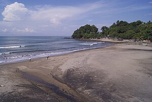
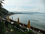
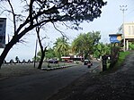
Clockwise, from top left : Karanghawu Beach, Streetscape of Pelabuhan Ratu, Cikaso waterfall, Pelabuhan Ratu Bay
|
||||||
|
||||||
| Motto: Gemah Ripah Loh Jinawi | ||||||
| Location of Sukabumi Regency in Indonesia | ||||||
| Coordinates: 6°55′S 106°55′E / 6.917°S 106.917°E | ||||||
| Country | Indonesia | |||||
| Province | West Java | |||||
| Government | ||||||
| • Regent | Drs. H. Sukmawijaya, MM | |||||
| Area | ||||||
| • Total | 4,145.70 km2 (1,600.66 sq mi) | |||||
| Population (2014) | ||||||
| • Total | 2,517,982 | |||||
| Time zone | WIB (UTC+7) | |||||
| Area code(s) | 0266 | |||||
| Website | http://www.kabupatensukabumi.go.id | |||||
Sukabumi Regency Indonesian: Kabupaten Sukabumi is a regency (kabupaten) in the West Java Province, Indonesia. The regency seat is located in Pelabuhan Ratu, a coastal city facing the Indian Ocean. The regency fully encircles the administratively separated city of Sukabumi. The regency is the second largest regency by area in Java after the Banyuwangi Regency in East Java.
The regency covered an area of 4,145.70 km2, the largest in West Java, and has a population of 2,341,409 at the 2010 Census. The bulk of the regency's population of 2,517,982 (in January 2014) lives in the northeastern part of the regency that encircles Sukabumi City and Mount Gede. A plan to create a new regency, the North Sukabumi Regency is currently waiting for the approval of the central government.
The area around Sukabumi was already inhabited at least in the 11th century. The first written record found in this area was the Sanghyang Tapak Stone in Cibadak, 20 km west of the city. Written in Kawi script, the stone tells about the prohibition of fishing activity in the nearby river by the authorities of the Sunda Kingdom.
At the end of the 16th century, the area was captured by the Banten Sultanate, after the fall of the Sunda Kingdom. The area however became contested in the 1620s between Banten, the Mataram Sultanate in the east and the Batavia-based Dutch East India Company. After a series of military clashes between them, the area was included in a buffer zone territory between Banten and Mataram, although the area is considered de jure as a part of Mataram.
...
Wikipedia


