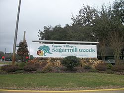
Sugarmill Woods, Florida
| Sugarmill Woods, Florida | |
|---|---|
| Census-designated place | |

|
|
 Location in Citrus County and the state of Florida |
|
| Coordinates: 28°44′0″N 82°31′22″W / 28.73333°N 82.52278°WCoordinates: 28°44′0″N 82°31′22″W / 28.73333°N 82.52278°W | |
| Country |
|
| State |
|
| County | Citrus |
| Area | |
| • Total | 26.6 sq mi (68.8 km2) |
| • Land | 26.6 sq mi (68.8 km2) |
| • Water | 0 sq mi (0 km2) |
| Elevation | 82 ft (25 m) |
| Population (2010) | |
| • Total | 8,287 |
| • Density | 312/sq mi (120.5/km2) |
| Time zone | Eastern (EST) (UTC-5) |
| • Summer (DST) | EDT (UTC-4) |
| FIPS code | 12-68950 |
| GNIS feature ID | 1867212 |
Sugarmill Woods is an unincorporated community and census-designated place (CDP) in Citrus County, Florida, United States. The population was 8,287 at the 2010 census, up from 6,409 in 2000.
Sugarmill Woods is located in southern Citrus County at 28°44′0″N 82°31′22″W / 28.73333°N 82.52278°W (28.733285, -82.522829). It is bordered to the north Homosassa Springs and Lecanto, and to the south by Hernando County. U.S. Routes 19 and 98 (Suncoast Boulevard) form the western border of the CDP, and U.S. 98 after turning to become Ponce de Leon Boulevard forms the southwestern border. The Suncoast Parkway (State Road 589) has its northern terminus at US 98 just south of the Hernando County line and leads 55 miles (89 km) south to Tampa.
According to the United States Census Bureau, the Sugarmill Woods CDP has a total area of 26.6 square miles (68.8 km2), all land.
Sugarmill Woods was created in 1972. It was the first residential area in the United States to incorporate "wildlife strips" or greenbelts in the planning of the community.
As of the census of 2000, there were 6,409 people, 3,061 households, and 2,378 families residing in the CDP. The population density was 243.0 people per square mile (93.8/km²). There were 3,440 housing units at an average density of 130.5/sq mi (50.4/km²). The racial makeup of the CDP was 97.74% White, 0.89% African American, 0.19% Native American, 0.81% Asian, 0.02% Pacific Islander, 0.06% from other races, and 0.30% from two or more races. Hispanic or Latino of any race were 1.39% of the population.
...
Wikipedia
