Sugarloaf Township, Luzerne County, Pennsylvania
| Sugarloaf Township, Luzerne County, Pennsylvania |
|
|---|---|
| Township | |
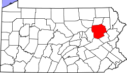
 Map of Luzerne County, Pennsylvania Highlighting Sugarloaf Township |
|
 Map of Luzerne County, Pennsylvania |
|
| Country | United States |
| State | Pennsylvania |
| County | Luzerne |
| Area | |
| • Total | 22.5 sq mi (58.2 km2) |
| • Land | 22.5 sq mi (58.2 km2) |
| • Water | 0 sq mi (0 km2) |
| Population (2010) | |
| • Total | 4,211 |
| • Density | 190/sq mi (72/km2) |
| Time zone | Eastern (EST) (UTC-5) |
| • Summer (DST) | EDT (UTC-4) |
Sugarloaf Township is a township in Luzerne County, Pennsylvania, United States. The population was 4,211 at the 2010 census.
According to the United States Census Bureau, the township has a total area of 22.5 square miles (58.2 km2), of which 22.5 square miles (58.2 km2) is land and 0.07% is water.
The township is drained by the Susquehanna River and Nescopeck Mountain forms its natural northern boundary. Its unincorporated communities include Black Ridge, Council Crest, Sybertsville, and Tomhicken. Route 93 serves the township and interchanges with Interstate 80 in the township. Interstate 81 crosses the southeastern corner of Sugarloaf, where it interchanges with 93 in Black Ridge.
Sugarloaf Township encircles the borough of Conyngham.
As of the census of 2000, there were 3,652 people, 1,222 households, and 944 families residing in the township. The population density was 166.6 people per square mile (64.4/km2). There were 1,302 housing units at an average density of 59.4/sq mi (22.9/km2). The racial makeup of the township was 98.03% White, 0.27% African American, 0.11% Native American, 1.01% Asian, 0.22% from other races, and 0.36% from two or more races. Hispanic or Latino of any race were 0.71% of the population.
...
Wikipedia
