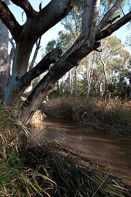
Sturt River, Adelaide
| Sturt (Kaurna: Warri Parri) | |
| Sturt Creek | |
| River | |
|
The Sturt River in Warriparinga
|
|
| Name origin: Charles Sturt | |
| Country | Australia |
|---|---|
| State | South Australia |
| Region | Adelaide |
| Source | Adelaide Hills |
| - location | Upper Sturt |
| - elevation | 395 m (1,296 ft) |
| Mouth | confluence with the Patawalonga River |
| - location | Glenelg North |
| - elevation | 0 m (0 ft) |
| - coordinates | 34°57′40″S 138°30′56″E / 34.9611°S 138.5156°ECoordinates: 34°57′40″S 138°30′56″E / 34.9611°S 138.5156°E |
| Length | 27 km (17 mi) |
| Basin | 120 km2 (46 sq mi) |
| Nature reserve | Sturt Gorge Recreation Park |
|
Location of the river mouth in South Australia
|
|
The Sturt River, also known as the Sturt Creek and Warri Parri in the Kaurna language, is a river located in the Adelaide region of the Australian state of South Australia.
The Sturt River rises in Upper Sturt in the Adelaide Hills, it flows through Coromandel Valley, the Sturt Gorge Recreation Park, Marion and Morphettville, before meeting the Patawalonga River in Glenelg North. Along with Brown Hill Creek, it is one of the Patawalonga's most important tributaries. It is considered a significant urban waterway, and was used by the indigenous Kaurna people as a link between the hills and the sea. The Sturt River catchment area extends over 120 square kilometres (46 sq mi), from Heathfield in the Mount Lofty Ranges, to Glenelg North. The river descends 395 metres (1,296 ft) over its 27-kilometre (17 mi) course.
The first inhabitants of the greater Adelaide area, the Kaurna people, referred to Sturt River as Warri Parri, or 'the windy place by the river'. They used it as a movement corridor between the Adelaide Hills and the sea. The river is also significant in Kaurna Dreaming, especially the area known as Warriparinga, where the river leaves its gorge to cross the Adelaide Plains. Other important Kaurna campsites were located south of the Sturt-Patawalonga confluence, and at Chambers Gully in Coromandel Valley.
...
Wikipedia


