Stromberg region
| Stromberg | |
|---|---|

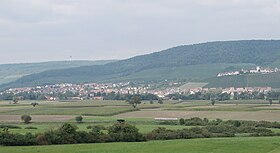
Stromberg main chain with the Hohenhaslach in the Kirbach valley and the Brackenheim 1 transmission tower (on the horizon) from the south
|
|
| Highest point | |
| Peak | Baiselsberg |
| Elevation | 476.6 m above NN |
| Geography | |
| State | counties of Enzkreis, Karlsruhe, Heilbronn and Ludwigsburg, Baden-Württemberg, Germany |
| Range coordinates | 49°00′14″N 8°59′19″E / 49.003750°N 8.98861°ECoordinates: 49°00′14″N 8°59′19″E / 49.003750°N 8.98861°E |
| Parent range | South German Scarplands |
| Geology | |
| Orogeny | Schichtstufe |
| Type of rock | Keuper, Reed sandstone, Lower Bunter Marl, Upper Bunter Marl, Stubensandstein |
The Stromberg is a heavily forested hill ridge up to 476.6 m above sea level (NN) in the northern part of the German state of Baden-Württemberg.
...
Wikipedia

