Strathcona Provincial Park
| Strathcona Provincial Park | |
|---|---|
|
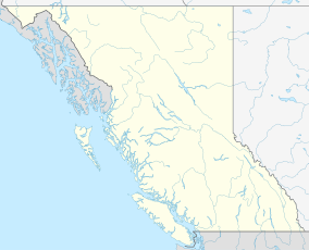
Location of Strathcona Provincial Park in British Columbia
|
|
| Location | British Columbia, Canada |
| Nearest city | Gold River, Campbell River |
| Coordinates | 49°52′27″N 125°44′38″W / 49.87417°N 125.74389°WCoordinates: 49°52′27″N 125°44′38″W / 49.87417°N 125.74389°W |
| Area | 2,458.07 km2 |
| Established | 1911 |
| Governing body | BC Parks |
Strathcona Provincial Park is the oldest provincial park in British Columbia, Canada, and the largest on Vancouver Island. Founded in 1911, the park was named for Donald Alexander Smith, 1st Baron Strathcona and Mount Royal, a wealthy philanthropist and railroad pioneer. It lies within the Strathcona Regional District. The Clayoquot Sound UNESCO Biosphere Reserve, established in 2000, includes three watersheds in the western area of the park.
The park is 9 km east of Gold River and 25 km west of Campbell River. At 2,458 square kilometres, it contains a group of mountains called the Elk River Mountains. It contains the highest peaks of the Vancouver Island Ranges. Some notable mountains located within the park boundaries include:
For others, see the List of mountains in Strathcona Provincial Park.
Strathcona Park is also known for its lakes, waterfalls, and glaciers. Buttle Lake is a popular destination for swimming, canoeing, kayaking, and fishing. Also located in the park is Della Falls which, at 440 m in height, is widely considered the highest waterfall in Canada.
The 6,500 meter thick Karmutsen Formation is the most abundant rock unit in the park. It is a pile of tholeiitic pillow basalts and breccias. It is also the oldest, thickest and most widespread formation on Vancouver Island found on Triple Peak, Cat's Ears Peak and the Mackenzie Range.
...
Wikipedia

