Strafford County, New Hampshire
| Strafford County, New Hampshire | ||
|---|---|---|

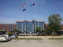
Strafford County Courthouse
|
||
|
||
 Location in the U.S. state of New Hampshire |
||
 New Hampshire's location in the U.S. |
||
| Founded | 1771 | |
| Named for | William Wentworth, 2nd Earl of Strafford | |
| Seat | Dover | |
| Largest city | Dover | |
| Area | ||
| • Total | 384 sq mi (995 km2) | |
| • Land | 369 sq mi (956 km2) | |
| • Water | 15 sq mi (39 km2), 3.9% | |
| Population | ||
| • (2010) | 123,143 | |
| • Density | 334/sq mi (129/km²) | |
| Congressional district | 1st | |
| Time zone | Eastern: UTC-5/-4 | |
| Website | www |
|
Strafford County is a county in the U.S. state of New Hampshire. As of the 2010 census, the population was 123,143. Its county seat is Dover. Strafford County was one of the five original counties identified for New Hampshire in 1769. It was named after William Wentworth, 2nd Earl of Strafford in the mistaken belief that he was the ancestor of governor John Wentworth. Although they were distantly related, William had no descendants.
The county was organized at Dover in 1771. In 1840 the original size of the county was reduced with the creation of Belknap County.
Strafford County is included in the Boston-Cambridge-Newton, MA-NH Metropolitan Statistical Area.
Strafford County is in southeastern New Hampshire, separated from York County in the state of Maine by the Salmon Falls River. The southern part of the Salmon Falls, from Rollinsford to Dover, is a tidal river that flows into the Piscataqua River.
According to the U.S. Census Bureau, the county has a total area of 384 square miles (990 km2), of which 369 square miles (960 km2) is land and 15 square miles (39 km2) (3.9%) is water. It is the smallest county in New Hampshire by area.
...
Wikipedia

