Stoddard County, Missouri
| Stoddard County, Missouri | |
|---|---|

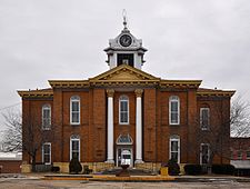
Stoddard County Courthouse, February 2014
|
|
 Location in the U.S. state of Missouri |
|
 Missouri's location in the U.S. |
|
| Founded | January 2, 1835 |
| Named for | Amos Stoddard |
| Seat | Bloomfield |
| Largest city | Dexter |
| Area | |
| • Total | 829 sq mi (2,147 km2) |
| • Land | 823 sq mi (2,132 km2) |
| • Water | 5.8 sq mi (15 km2), 0.7% |
| Population (est.) | |
| • (2015) | 29,862 |
| • Density | 36/sq mi (14/km²) |
| Congressional district | 8th |
| Time zone | Central: UTC-6/-5 |
| Stoddard County, Missouri | ||||
|---|---|---|---|---|
| Elected countywide officials | ||||
| Assessor | Jody Lemmon | Democratic | ||
| Circuit Clerk | Sherry L. Disney | Democratic | ||
| County Clerk | Joe Watson | Republican | ||
|
Commissioner (Presiding) |
Greg Mathis | Democratic | ||
|
Commissioner (District 1) |
Danny Talkington | Republican | ||
|
Commissioner (District 2) |
Carol Jarrell | Republican | ||
| Prosecuting Attorney | Russ Oliver | Republican | ||
| Public Administrator | Pamela Lape | Democratic | ||
| Recorder | Kay Asbell | Democratic | ||
| Sheriff | Carl Hefner | Republican | ||
| Surveyor | Dan Fisher | Republican | ||
| Treasurer | Carla Moore | Democratic | ||
| Stoddard County, Missouri | ||
|---|---|---|
| 2008 Republican primary in Missouri | ||
| John McCain | 772 (24.85%) | |
| Mike Huckabee | 1,571 (50.56%) | |
| Mitt Romney | 643 (20.70%) | |
| Ron Paul | 91 (2.93%) | |
| Stoddard County, Missouri | ||
|---|---|---|
| 2008 Democratic primary in Missouri | ||
| Hillary Clinton | 2,225 (72.95%) | |
| Barack Obama | 684 (22.43%) | |
| John Edwards (withdrawn) | 112 (3.67%) | |
Stoddard County is a county located in the southeastern portion of the U.S. state of Missouri. As of the 2010 census, the population was 29,968. The county seat is Bloomfield. The county was officially organized on January 2, 1835, and is named for Amos Stoddard, the first American Civil Commandant of Upper Louisiana.
According to the U.S. Census Bureau, the county has a total area of 829 square miles (2,150 km2), of which 823 square miles (2,130 km2) is land and 5.8 square miles (15 km2) (0.7%) is water.
As of the census of 2000, there 29,705 people, 12,064 households, and 8,480 families residing in the county. The population density was 36 people per square mile (14/km²). There were 13,221 housing units at an average density of 16 per square mile (6/km²). The racial makeup of the county was 97.34% White, 0.91% Black or African American, 0.40% Native American, 0.09% Asian, 0.01% Pacific Islander, 0.24% from other races, and 1.01% from two or more races. Approximately 0.78% of the population were Hispanic or Latino of any race. 38.4% were of American, 15.4% German, 12.4% Irish and 8.5% English ancestry.
...
Wikipedia
