Stiperstones
| Stiperstones | |
|---|---|

Manstone Rock
|
|
| Highest point | |
| Elevation | 536 m (1,759 ft) |
| Prominence | 357 m (1,171 ft) |
| Parent peak | Plynlimon |
| Listing | Marilyn |
| Coordinates | 52°34′55″N 2°56′06″W / 52.58194°N 2.93500°WCoordinates: 52°34′55″N 2°56′06″W / 52.58194°N 2.93500°W |
| Geography | |
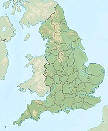
| Location | Shropshire, England |
| Topo map | OS Landranger 137 |
The Stiperstones is a distinctive hill in the county of Shropshire, England. It is a quartzite ridge formed some 480 million years ago. During the last Ice Age the summit stood out above the glaciers and was subject to constant freezing and thawing which shattered the quartzite into a mass of jumbled scree surrounding several residual rocky tors. At 536 metres (1,759 ft) above sea level it is the second-highest hill in the county, surpassed only by Brown Clee Hill (540 metres (1,772 ft)). Stiperstones' 8-kilometre (5 mi) summit ridge is crowned by several rugged, jagged outcrops of rock silhouetted against the sky.
The Stiperstones is noted for its tors of quartzite. The principal ones are named as follows, from north-east to south-west:
Manstone Rock is the highest of these at 536 metres (1,759 ft), and is topped with a trig point. The Devil's Chair is the largest and best known.
The Stiperstones ridge is a good place to view the upland landscape of the Shropshire Hills, particularly the Long Mynd to the east, and also gives extensive views towards the North Shropshire plain and the hills of Mid Wales.
The Stiperstones is a National Nature Reserve and Site of Special Scientific Interest (SSSI). and is within the Shropshire Hills Area of Outstanding Natural Beauty. It is a haven for wildlife, with birds that are normally associated with upland areas present, including red grouse, Eurasian curlew, peregrine falcon and the rare ring ouzel.
...
Wikipedia

