Steuben Township, Warren County, Indiana
| Steuben Township | |
|---|---|
| Township | |

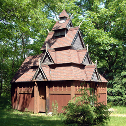
Saint Swithuns Church, a replica stave church in the township
|
|
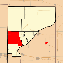
 Location of Steuben Township in Warren County |
|
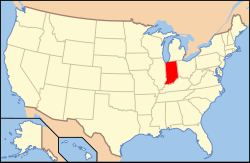
 Location of Indiana in the United States |
|
| Coordinates: 40°14′57″N 87°27′40″W / 40.24917°N 87.46111°WCoordinates: 40°14′57″N 87°27′40″W / 40.24917°N 87.46111°W | |
| Country | United States |
| State | Indiana |
| County | Warren |
| Government | |
| • Type | Indiana township |
| Area | |
| • Total | 39.57 sq mi (102.5 km2) |
| • Land | 39.55 sq mi (102.4 km2) |
| • Water | 0.03 sq mi (0.08 km2) 0.08% |
| Elevation | 692 ft (211 m) |
| Population (2010) | |
| • Total | 487 |
| • Density | 12.3/sq mi (4.7/km2) |
| Time zone | Eastern (EST) (UTC-5) |
| • Summer (DST) | EDT (UTC-4) |
| Area code(s) | 765 |
| GNIS feature ID | 453875 |
Steuben Township is one of twelve townships in Warren County, Indiana, United States. It was established in 1834. According to the 2010 census, its population was 487 and it contained 199 housing units. It contains no incorporated towns and is largely agricultural.
The area that became Steuben Township was first settled in 1827. The township was officially created in March 1834 from a section of Pine Township ("all of Pine Township south and west of Redwood Creek") and was the seventh township to be formed. The township was named in honor of Baron Von Steuben, a Prussian soldier who fought for the Americans in the Revolutionary War.
The first settlements were in the more wooded areas near the river; it was only later that settlers realized the value of the prairie land for farming. The township grew rapidly in the 1830s and 1840s. In 1870, the population was 1068, and in 1882 the estimated taxable value in the Steuben Township was $770,905, higher than any of the other townships at that time.
According to the 2010 census, the township has a total area of 39.57 square miles (102.5 km2), of which 39.55 square miles (102.4 km2) (or 99.95%) is land and 0.03 square miles (0.078 km2) (or 0.08%) is water. Most of its area is given over to agriculture. In the southeast there is approximately one mile of frontage on the Wabash River. The north and west portions are mostly open prairie and excellent farmland, whereas the south and east portions are more hilly and wooded. The streams of Chesapeake Creek, Mud Run and Possum Run pass through this township.
Steuben Township contains the towns of Johnsonville and Marshfield. The town of Chesapeake no longer exists, but was the first town in Steuben Township, about two miles east of present-day Marshfield; the first meetings of the township trustees were held there in the 1830s. Sloan, a small community that once existed on the township's northern border, is also extinct. The short-lived town of Dresser existed in the southeast part of the township around the turn of the 20th century.
...
Wikipedia
