State Center, Iowa
| State Center, Iowa | |
|---|---|
| City | |
| Nickname(s): Rose Capital of Iowa | |
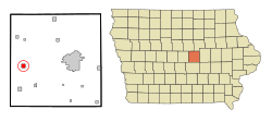
 Location of State Center, Iowa |
|
| Coordinates: 42°0′57″N 93°9′51″W / 42.01583°N 93.16417°WCoordinates: 42°0′57″N 93°9′51″W / 42.01583°N 93.16417°W | |
| Country |
|
| State |
|
| County | Marshall |
| Area | |
| • Total | 0.98 sq mi (2.54 km2) |
| • Land | 0.98 sq mi (2.54 km2) |
| • Water | 0 sq mi (0 km2) |
| Elevation | 1,070 ft (326 m) |
| Population (2010) | |
| • Total | 1,468 |
| • Estimate (2016) | 1,452 |
| • Density | 1,498/sq mi (578.4/km2) |
| Time zone | Central (CST) (UTC-6) |
| • Summer (DST) | CDT (UTC-5) |
| ZIP code | 50247 |
| Area code(s) | 641 |
| FIPS code | 19-75135 |
| GNIS feature ID | 0461964 |
| Website | http://www.statecenteriowa.org/ |
State Center is a city in Marshall County, Iowa, United States. The population was 1,468 at the 2010 census. State Center is the Rose Capital of Iowa.
State Center had its start in the year 1864 by the building of the railroad through that territory. It was named for its location near the geographical center of the state.
State Center is located at 42°00′57″N 93°09′51″W / 42.015947°N 93.164238°W (42.015947, -93.164238).
According to the United States Census Bureau, the city has a total area of 0.98 square miles (2.54 km2), all land.
As of the census of 2010, there were 1,468 people, 568 households, and 399 families residing in the city. The population density was 1,498.0 inhabitants per square mile (578.4/km2). There were 630 housing units at an average density of 642.9 per square mile (248.2/km2). The racial makeup of the city was 96.7% White, 0.5% African American, 0.1% Native American, 0.3% Asian, 1.2% from other races, and 1.2% from two or more races. Hispanic or Latino of any race were 3.5% of the population.
...
Wikipedia
