Stanhope, New Jersey
| Stanhope, New Jersey | |
|---|---|
| Borough | |
| Borough of Stanhope | |

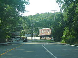
File:NJ Route 183 northbound
|
|
 Map of Stanhope in Sussex County. Inset: Location of Sussex County highlighted in the State of New Jersey. |
|
 Census Bureau map of Stanhope, New Jersey |
|
| Coordinates: 40°54′47″N 74°42′10″W / 40.912976°N 74.702914°WCoordinates: 40°54′47″N 74°42′10″W / 40.912976°N 74.702914°W | |
| Country |
|
| State |
|
| County | Sussex |
| Incorporated | March 24, 1904 |
| Government | |
| • Type | Borough |
| • Body | Borough Council |
| • Mayor | Rosemary Maio (R, term ends December 31, 2019) |
| • Administrator | Brian McNeilly |
| • Clerk | Ellen Horak |
| Area | |
| • Total | 2.188 sq mi (5.667 km2) |
| • Land | 1.836 sq mi (4.755 km2) |
| • Water | 0.352 sq mi (0.912 km2) 16.10% |
| Area rank | 395th of 566 in state 20th of 24 in county |
| Elevation | 961 ft (293 m) |
| Population (2010 Census) | |
| • Total | 3,610 |
| • Estimate (2015) | 3,410 |
| • Rank | 427th of 566 in state 14th of 24 in county |
| • Density | 1,966.3/sq mi (759.2/km2) |
| • Density rank | 293rd of 566 in state 4th of 24 in county |
| Time zone | Eastern (EST) (UTC-5) |
| • Summer (DST) | Eastern (EDT) (UTC-4) |
| ZIP code | 07874 |
| Area code(s) | 973 |
| FIPS code | 3403770380 |
| GNIS feature ID | 0885408 |
| Website | stanhopenj |
Stanhope is a borough in Sussex County, New Jersey, United States. As of the 2010 United States Census, the borough's population was 3,610, reflecting an increase of 26 (+0.7%) from the 3,584 counted in the 2000 Census, which had in turn increased by 191 (+5.6%) from the 3,393 counted in the 1990 Census.
Stanhope was formed by an act of the New Jersey Legislature on March 24, 1904, from portions of Byram Township.
According to the United States Census Bureau, Stanhope borough had a total area of 2.188 square miles (5.667 km2), including 1.836 square miles (4.755 km2) of land and 0.352 square miles (0.912 km2) of water (16.1%).
Unincorporated communities, localities and place names located partially or completely within the borough include Lake Musconetcong.
As of the census of 2010, there were 3,610 people, 1,396 households, and 957.7 families residing in the borough. The population density was 1,966.3 per square mile (759.2/km2). There were 1,472 housing units at an average density of 801.8 per square mile (309.6/km2). The racial makeup of the borough was 91.36% (3,298) White, 1.58% (57) Black or African American, 0.08% (3) Native American, 2.33% (84) Asian, 0.00% (0) Pacific Islander, 2.63% (95) from other races, and 2.02% (73) from two or more races. Hispanic or Latino of any race were 8.50% (307) of the population.
...
Wikipedia
