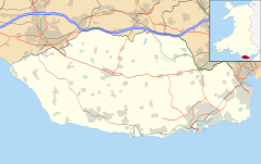
St Brides Major (community)
| St Brides Major | |
|---|---|
 Coastal cliffs at Southerndown, St Brides Major |
|
| St Brides Major shown within the Vale of Glamorgan | |
| Area | 20.44 km2 (7.89 sq mi) |
| Population | 1,940 |
| • Density | 95/km2 (250/sq mi) |
| East | |
| Principal area | |
| Country | Wales |
| Sovereign state | United Kingdom |
| Police | South Wales |
| Fire | South Wales |
| Ambulance | Welsh |
| EU Parliament | Wales |
St Brides Major is a community on the western edge of the Vale of Glamorgan, South Wales. Its largest settlement is the village of St Brides Major, and also includes the villages of Ogmore-by-Sea and Southerndown, and the hamlets of Ogmore Village, Castle-upon-Alun, Heol-y-Mynydd, Norton and Pont-yr-Brown It is notable for coastal geology and scenery, limestone downlands and fossilised primitive mammals, sea cliffs and beaches, two Iron Age hillforts, three medieval castle sites, (one, Ogmore Castle, still extant), two stepping stone river crossings and a clapper bridge. Three long distance paths cross the community. It is the western limit of the Vale of Glamorgan Heritage Coast, and has a visitor centre and tourist facilities.
5 kilometres (3.1 mi) of south-west facing coastline forms one side of the community. This is an SSSI and part of the Vale of Glamorgan Heritage Coast, with rocky limestone cliffs, broad sandy beaches and deeply fissured wave-cut platforms. Along the northern boundary are the steep-sided valleys of the Rivers Ogmore and Ewenny. The high ground above these valleys includes large areas of common grazing land, on thin limestone soils, including Old Castle Down SSSI. The southern part of the community includes the village of St Brides Major, the Dunraven estate and Clemenstone Meadow SSSI.
Much of the coastline of the community is designated as the Southerndown Coast SSSI, both for its geology and botanic value. The 153 hectares (380 acres) stretch of shore, cliff, cliff-top, and several short, steep valleys, reveal the local geological strata. Carboniferous Limestone from upwards of 300 million years ago lies at the present sea level. By the Triassic period, 200 million years ago, these rocks were already tilted and eroded. A new deposition phase created more sedimentary rocks, including a red Triassic conglomerate, and a creamy white Jurassic limestone known as Sutton Stone, a freestone much sought-after for carved stonework, and so widely quarried where it occurs.
...
Wikipedia

