St. Paris, Ohio
| St. Paris, Ohio | |
|---|---|
| Village | |

The Monitor House, a historic site in the village
|
|
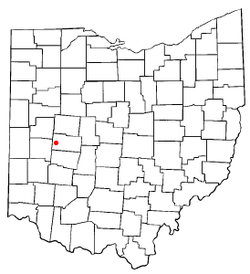
 Location of St. Paris, Ohio |
|
 Location of St. Paris in Champaign County |
|
| Coordinates: 40°7′41″N 83°57′36″W / 40.12806°N 83.96000°WCoordinates: 40°7′41″N 83°57′36″W / 40.12806°N 83.96000°W | |
| Country | United States |
| State | Ohio |
| County | Champaign |
| Government | |
| • Mayor | Joe Reneer |
| Area | |
| • Total | 1.68 sq mi (4.35 km2) |
| • Land | 1.68 sq mi (4.35 km2) |
| • Water | 0 sq mi (0 km2) |
| Elevation | 1,207 ft (368 m) |
| Population (2010) | |
| • Total | 2,089 |
| • Estimate (2012) | 2,057 |
| • Density | 1,243.5/sq mi (480.1/km2) |
| Time zone | Eastern (EST) (UTC-5) |
| • Summer (DST) | EDT (UTC-4) |
| ZIP code | 43072 |
| Area code(s) | 937 |
| FIPS code | 39-69708 |
| GNIS feature ID | 1065272 |
| Website | stparisohio.org |
St. Paris is a village in Champaign County, Ohio, United States. The population was 2,089 at the 2010 census.
The area where St. Paris now stands was originally inhabited by Native Americans. The first white settlers arrived in 1797 and the village was founded in 1831 by David Huffman, who originally named it New Paris, after the French capital city of Paris. Upon learning that another town in Ohio already had that name, he changed the name to St. Paris. St. Paris was incorporated as a village in 1858.
One of the houses in the village, known as the "Monitor House", has been declared a historic site and is listed on the National Register of Historic Places.
St. Paris is located at 40°7′41″N 83°57′36″W / 40.12806°N 83.96000°W (40.128173, -83.959863).
According to the United States Census Bureau, the village has a total area of 1.68 square miles (4.35 km2), all of it land.
As of the census of 2010, there were 2,089 people, 795 households, and 549 families residing in the village. The population density was 1,243.5 inhabitants per square mile (480.1/km2). There were 857 housing units at an average density of 510.1 per square mile (197.0/km2). The racial makeup of the village was 97.8% White, 0.2% African American, 0.1% Native American, 0.2% Pacific Islander, 0.1% from other races, and 1.4% from two or more races. Hispanic or Latino of any race were 0.5% of the population.
...
Wikipedia
