St. Lucie County, Florida
| St. Lucie County, Florida | |
|---|---|

St. Lucie County Courthouse
|
|
| Nickname(s): "Loose County" | |
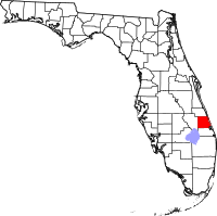
 Location in the U.S. state of Florida |
|
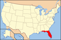
 Florida's location in the U.S. |
|
| Founded | May 24, 1905 |
| Named for | Saint Lucie of Syracuse |
| Seat | Fort Pierce |
| Largest city | Port St. Lucie |
| Area | |
| • Total | 688 sq mi (1,782 km2) |
| • Land | 572 sq mi (1,481 km2) |
| • Water | 116 sq mi (300 km2), 16.9% |
| Population (est.) | |
| • (2015) | 298,563 |
| • Density | 486/sq mi (188/km²) |
| Congressional district | 18th |
| Time zone | Eastern: UTC-5/-4 |
| Website | www |
St. Lucie County is a county located in the state of Florida, in the United States. As of the 2010 census, the population was 277,789. The county seat is Fort Pierce. As of the 2015 Census Estimate, St. Lucie County is at a population of 298,563.
St. Lucie County is included in the Port St. Lucie, FL Metropolitan Statistical Area, which is also included in the Miami-Fort Lauderdale-Port St. Lucie, FL Combined Statistical Area.
The area was originally inhabited by the Ais tribe, a hunter-gatherer culture whose territory extended from south of the St. John's river to the St. Lucie Inlet. Spanish explorers frequently encountered the fierce tribe as the Spanish treasure routes ran parallel in order to take advantage of the strong Gulfstream current. The area was given several names by the Spanish including Rio de Ays (later anglicized to Indian River) as well as Santa Lucia, named after the short-lived late 16th-century Spanish fort that bore its name farther south. The fabled 1715 Spanish treasure fleet sank off the area that is now St. Lucie County, leading to the regional naming of the area as the Treasure Coast.
During the early 19th century, the Spanish government issued several land grants in the area, one of which went to settler James Hutchinson. The grant contained 2,000 acres (8.1 km2) and today the barrier island Hutchinson Island still retains his name. During the mid-1800s, Seminoles and runaway slaves sought refuge in the virtually uninhabited area. By 1837 the Second Seminole war had broken out in Florida. In December 1837, a group of soldiers under the command of Lt. Colonel Benjamin K. Pierce sailed down the Indian River and established a fort, naming it after their commander. Today the county seat of St. Lucie County is still known as Fort Pierce. In 1841, the United States government began issuing land grants under the Armed Occupation Act to Americans who were willing to settle the area. Several of these grants were within the boundaries of today's St. Lucie County. The Third Seminole War in 1851 saw the building of a second major American fort in the area, Fort Capron, located in the area that is today's St. Lucie Village.
...
Wikipedia
