St. Joseph County, Michigan
| Saint Joseph County, Michigan | ||
|---|---|---|
|
||
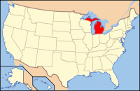
 Location in the U.S. state of Michigan |
||
 Michigan's location in the U.S. |
||
| Founded | 1829 | |
| Seat | Centreville | |
| Largest city | Sturgis | |
| Area | ||
| • Total | 521 sq mi (1,349 km2) | |
| • Land | 501 sq mi (1,298 km2) | |
| • Water | 20 sq mi (52 km2), 3.9% | |
| Population | ||
| • (2010) | 61,295 | |
| • Density | 122/sq mi (47/km²) | |
| Congressional district | 6th | |
| Time zone | Eastern: UTC-5/-4 | |
| Website | www |
|
St. Joseph County is a county located in the U.S. state of Michigan. As of the 2010 census, the population was 61,295. The county seat is Centreville. The county takes its name from Saint Joseph, patron saint of New France. It was set off and organized in 1829.
St. Joseph County comprises the Sturgis, MI Micropolitan Statistical Area and is included in the Kalamazoo-Battle Creek-Portage, MI Combined Statistical Area.
According to the U.S. Census Bureau, the county has a total area of 521 square miles (1,350 km2), of which 501 square miles (1,300 km2) is land and 20 square miles (52 km2) (3.9%) is water. It is the fourth-smallest county in Michigan by total area. The entire county is within the Saint Joseph River watershed.
The 2010 United States Census indicates St. Joseph County had a 2010 population of 61,295. This is a decrease of -1,127 people from the 2000 United States Census. Overall, the county had a -1.8% growth rate during this ten-year period. In 2010 there were 23,244 households and 16,275 families in the county. The population density was 122.4 per square mile (47.3 square kilometers). There were 27,778 housing units at an average density of 55.5 per square mile (21.4 square kilometers). The racial and ethnic makeup of the county was 88.0% White, 2.5% Black or African American, 0.4% Native American, 0.7% Asian, 6.6% Hispanic or Latino, 0.1% from other races, and 1.8% from two or more races.
...
Wikipedia

