St. John's South–Mount Pearl
|
|
|||
|---|---|---|---|

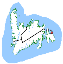
St. John's South—Mount Pearl in relation to other Newfoundland and Labrador ridings
|
|||
| Federal electoral district | |||
| Legislature | House of Commons | ||
| MP |
Liberal |
||
| District created | 2003 | ||
| First contested | 2004 | ||
| Last contested | 2015 | ||
| District webpage | profile, map | ||
| Demographics | |||
| Population (2011) | 81,944 | ||
| Electors (2015) | 66,936 | ||
| Area (km²) | 503 | ||
| Pop. density (per km²) | 162.9 | ||
| Census divisions | Division 1 | ||
| Census subdivisions | St. John's, Mount Pearl, Bay Bulls, Petty Harbour-Maddox Cove, Witless Bay | ||
St. John's South redirects here. For the provincial electoral district please see St. John's South (provincial electoral district)
St. John's South—Mount Pearl (French: St. John's-Sud—Mount Pearl; formerly St. John's South) is a federal electoral district in Newfoundland and Labrador, Canada, that has been represented in the House of Commons of Canada since 2004.
Ethnic groups: 99.2% White
Languages: 98.7% English
Religions: 52.8% Catholic, 42.4% Protestant, 3.6% No affiliation
Average income: $25 379
The district includes the south end of the City of St. John's, the City of Mount Pearl, and the Town of Petty Harbour-Maddox Cove.
The neighbouring ridings are Avalon and St. John's East.
According to Elections Canada, the geographic boundaries of this riding for the 39th General Election are:
See also Elections Canada's map of the riding (.PDF).
The electoral district was created in 2003: 95.1% of the population of the riding came from St. John's West, and 4.9% from St. John's East ridings. As of the 2012 electoral redistribution, 5% of this riding will be moved to St. John's East, and it will gain 3% from Avalon.
...
Wikipedia
