Springfield, Virginia
| Springfield, Virginia | ||
|---|---|---|
| Census-designated place (CDP) | ||

Central Springfield Business District, seen from Springfield Town Center
|
||
|
||
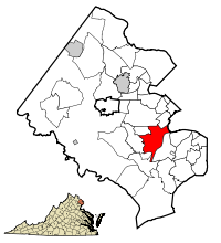
 Location of Springfield in Fairfax County, Virginia |
||
| Location of Springfield in Fairfax County, Virginia | ||
| Coordinates: 38°47′19″N 77°10′46″W / 38.78861°N 77.17944°WCoordinates: 38°47′19″N 77°10′46″W / 38.78861°N 77.17944°W | ||
| Country | United States | |
| State | Virginia | |
| County | Fairfax | |
| Area | ||
| • Total | 7.9 sq mi (20.4 km2) | |
| • Land | 7.9 sq mi (20.3 km2) | |
| • Water | 0.0 sq mi (0.1 km2) | |
| Elevation | 246 ft (75 m) | |
| Population (2010) | ||
| • Total | 30,484 | |
| • Density | 3,869.5/sq mi (1,494.3/km2) | |
| Time zone | Eastern (EST) (UTC-5) | |
| • Summer (DST) | EDT (UTC-4) | |
| Area code(s) | 703, 571 | |
| FIPS code | 51-74592 | |
| GNIS feature ID | 1493642 | |
Springfield is a census-designated place (CDP) in Fairfax County, Virginia, United States. The Springfield CDP is recognized by the U.S. Census Bureau with a population of 30,484 as of the 2010 census. Homes and businesses in bordering CDPs including North Springfield, West Springfield, and Newington are usually given a "Springfield" mailing address. The population of the collective areas with Springfield addresses is estimated to exceed 100,000. The CDP is a part of Northern Virginia, the most populous region of the Washington Metropolitan Area.
Springfield is located at 38°46′45″N 77°11′4″W / 38.77917°N 77.18444°W (38.779238, −77.184636).
According to the United States Census Bureau, the CDP has a total area of 7.9 square miles (20.4 km²), of which, 7.9 square miles (20.3 km²) of it is land and 0.04 square miles (0.1 km²) of it (0.49%) is water.
The area is dominated by the interchange of I-95, I-395, and the Capital Beltway (I-495), known as the Springfield Interchange. The center of the town is at the intersection of Route 644 (Old Keene Mill Road / Franconia Road) and Route 617 (Backlick Road) adjacent to the interchange. A significant commercial district exists around the interchange area, but the rest of the community is primarily residential in character.
...
Wikipedia


