Spirit Lake, Iowa
| Spirit Lake, Iowa | |
|---|---|
| City | |

Spirit Lake, Iowa
|
|
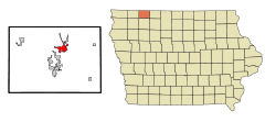
 Location of Spirit Lake, Iowa |
|
 The town of Spirit Lake, in the Iowa Great Lakes region. Map courtesy of USGS |
|
| Coordinates: 43°25′23″N 95°6′15″W / 43.42306°N 95.10417°WCoordinates: 43°25′23″N 95°6′15″W / 43.42306°N 95.10417°W | |
| Country |
|
| State |
|
| County | Dickinson |
| Incorporated | October 14, 1878 |
| Area | |
| • Total | 4.65 sq mi (12.04 km2) |
| • Land | 4.63 sq mi (11.99 km2) |
| • Water | 0.02 sq mi (0.05 km2) |
| Elevation | 1,473 ft (449 m) |
| Population (2010) | |
| • Total | 4,840 |
| • Estimate (2012) | 4,925 |
| • Density | 1,045.4/sq mi (403.6/km2) |
| Time zone | Central (CST) (UTC-6) |
| • Summer (DST) | CDT (UTC-5) |
| ZIP code | 51360 |
| Area code(s) | 712 |
| FIPS code | 19-74415 |
| GNIS feature ID | 0461851 |
Spirit Lake is a city in Dickinson County, Iowa, United States. The population was 4,840 at the 2010 census. It is the county seat of Dickinson County.
The town is located along the western shore of East Okoboji Lake, in the Iowa Great Lakes region.
The Dakota Sioux originated the name of "Spirit Lake" referring to it as "The Lake of The Spirit." In 1856, three brothers-in-law created the town of Spirit Lake after a visit to the Lakes area piqued their interest. The three brothers-in-law, O.C. Howe, B.F. Parmenter, and R.U. Wheelock, were soon joined by various other settlers, making homes along the lakes' shores. These settlers however, did not get along peacefully with the natives, and on March 13, 1857 Chief Inkpaduta of the Sioux led a revolt against the non-native settlers, killing all but four women.
According to the United States Census Bureau, the city has a total area of 4.65 square miles (12.04 km2), of which, 4.63 square miles (11.99 km2) is land and 0.02 square miles (0.05 km2) is water.
As of the census of 2010, there were 4,840 people, 2,157 households, and 1,268 families residing in the city. The population density was 1,045.4 inhabitants per square mile (403.6/km2). There were 2,578 housing units at an average density of 556.8 per square mile (215.0/km2). The racial makeup of the city was 97.7% White, 0.2% African American, 0.2% Native American, 0.6% Asian, 0.1% Pacific Islander, 0.1% from other races, and 1.1% from two or more races. Hispanic or Latino of any race were 1.3% of the population.
...
Wikipedia
