Spencer, Iowa
| Spencer, Iowa | |
|---|---|
| City | |
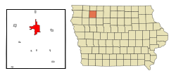
 Location of Spencer, Iowa |
|
| Coordinates: 43°8′43″N 95°8′50″W / 43.14528°N 95.14722°WCoordinates: 43°8′43″N 95°8′50″W / 43.14528°N 95.14722°W | |
| Country |
|
| State |
|
| County | Clay |
| Government | |
| • Type | Mayor-council |
| • Mayor | Reynold Peterson |
| Area | |
| • Total | 11.18 sq mi (28.96 km2) |
| • Land | 11.01 sq mi (28.52 km2) |
| • Water | 0.17 sq mi (0.44 km2) |
| Elevation | 1,312 ft (400 m) |
| Population (2010) | |
| • Total | 11,233 |
| • Estimate (2012) | 11,192 |
| • Density | 1,020.3/sq mi (393.9/km2) |
| Time zone | Central (CST) (UTC-6) |
| • Summer (DST) | CDT (UTC-5) |
| ZIP codes | 51301, 51343 |
| Area code(s) | 712 |
| FIPS code | 19-74280 |
| GNIS feature ID | 0465608 |
Spencer is a city in the state of Iowa (United States), and the county seat of Clay County. It is located at the confluence of the Little Sioux and Ocheyedan Rivers. The population was 11,233 in the 2010 census, a decline from 11,317 in the 2000 census. Spencer is famous as the home of the Clay County Fair, held annually in September, averaging over 300,000 visitors each year. The town's (now-deceased) library cat, Dewey Readmore Books, is known throughout the world.
The first house was built in what is now Spencer in 1866, and the first store was opened in the area in 1869.
Spencer was platted as a town in 1871. In 1878, Spencer experience growth when the Chicago, Milwaukee & St. Paul Railway was built into the settlement.
Spencer's longitude and latitude coordinates
in decimal form are 43.145318, 95.147209.
According to the United States Census Bureau, the city has a total area of 11.18 square miles (28.96 km2), of which, 11.01 square miles (28.52 km2) is land and 0.17 square miles (0.44 km2) is water. At one point Great Lakes Airlines was headquartered in Summit Township, Clay County, near Spencer.
As of the census of 2010, there were 11,233 people, 5,018 households, and 3,009 families residing in the city. The population density was 1,020.3 inhabitants per square mile (393.9/km2). There were 5,431 housing units at an average density of 493.3 per square mile (190.5/km2). The racial makeup of the city was 96.0% White, 0.5% African American, 0.3% Native American, 0.7% Asian, 1.3% from other races, and 1.2% from two or more races. Hispanic or Latino of any race were 3.5% of the population.
...
Wikipedia
