Southport (Fairfield)
| Southport | |
|---|---|
| Census-designated place | |

A view of Southport Harbour from neighbouring Sasco Hill.
|
|
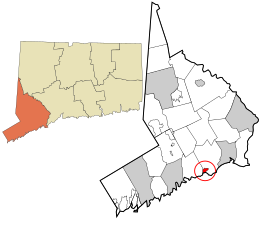
 Location in Fairfield County and the state of Connecticut. |
|
| Coordinates: 41°7′55″N 73°17′4″W / 41.13194°N 73.28444°WCoordinates: 41°7′55″N 73°17′4″W / 41.13194°N 73.28444°W | |
| Town | Fairfield |
| County | Fairfield |
| State | Connecticut |
| Settled | 1639 |
| Incorporated (borough) | 1831 |
| Disincorporated | 1854 |
| Population (2010) | |
| • Total | 1,585. |
| Zip code | 06890 |
| Area code | 203 |
Southport is a former borough in the town of Fairfield, Connecticut, and also a census-designated place. It is located along the Long Island Sound between Mill River and Sasco Brook, where it borders Westport. As of the 2010 census, it had a population of 1,585. Settled in 1639, Southport center has been designated a local historic district since 1967, and was listed on the National Register of Historic Places in 1971 as the Southport Historic District.
The earliest recorded event in Southport's history was "The Great Swamp Fight" or "Fairfield Swamp Fight" of July 1637 (not to be confused with the later Great Swamp Fight of King Philip's War), an episode of the Pequot War in which English colonial forces led by John Mason and Roger Ludlow vanquished a band of about 80 to 100 Pequot Indians who had earlier fled from their home territory in the Mystic area and had taken refuge with about 200 Sasqua Indians who inhabited the area that is now Fairfield. The exact location of the battle is not known, but it is known to have been in the vicinity of Southport.
In the eighteenth century, Mill River village, a part of Fairfield, was a small hamlet of a few houses and a wharf at the mouth of Fairfield's Mill River. Farm products from the surrounding area were shipped from Mill River's small harbor to ports in New York and beyond.
...
Wikipedia
