Southington, CT
| Southington, Connecticut | |||
|---|---|---|---|
| Town | |||

First Congregational Church in town center
|
|||
|
|||
| Motto: The City of Progress | |||
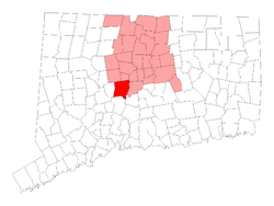
 Location within Hartford County, Connecticut |
|||
| Coordinates: 41°36′18″N 72°52′45″W / 41.60500°N 72.87917°WCoordinates: 41°36′18″N 72°52′45″W / 41.60500°N 72.87917°W | |||
| Country | United States | ||
| State | Connecticut | ||
| NECTA | Hartford | ||
| Region | Central Connecticut | ||
| Incorporated | 1779 | ||
| Consolidated | 1947 | ||
| Government | |||
| • Type | Council-manager | ||
| • Town manager | Garry Brumback | ||
| • Town council | Michael Riccio R, Chairman Cheryl Lounsbury R, Vice Chm. John Barry D Paul Champagne R Dawn Miceli D Tom Lombardi R Christopher Palmieri D Victoria Triano R Stephanie Urillo R |
||
| Area | |||
| • Total | 36.6 sq mi (94.9 km2) | ||
| • Land | 35.9 sq mi (93.0 km2) | ||
| • Water | 0.7 sq mi (1.9 km2) | ||
| Elevation | 154 ft (47 m) | ||
| Population (2010) | |||
| • Total | 43,069 | ||
| • Density | 1,200/sq mi (450/km2) | ||
| Time zone | Eastern (UTC-5) | ||
| • Summer (DST) | Eastern (UTC-4) | ||
| ZIP code | 06479, 06489, 06467, 06444 | ||
| Area code(s) | 860 | ||
| FIPS code | 09-70550 | ||
| GNIS feature ID | 0213508 | ||
| Website | www |
||
Southington is a town in Hartford County, Connecticut, United States. As of the 2010 United States Census, it had a population of 43,069. Southington contains the villages of Marion, Milldale, and Plantsville.
Southington is situated about 20 miles (32 km) southwest of Hartford, about 80 miles (130 km) northeast of New York City, 105 miles (169 km) southwest of Boston and 77 miles (124 km) west of Providence. It includes the areas of Plantsville, Marion and Milldale, each of which has its own post office and distinct architecture. The town rests in a valley of two mountains on its east and west sides. The town is located along exits 28 through 32 of Interstate 84, exit 4 of Interstate 691, and bisected by Connecticut Route 10. Southington has the nickname of "The Apple Valley", due to the many orchards that still dot its landscape. The Quinnipiac River flows through the town. It is home to Mount Southington ski area, which has drawn visitors since the 1960s.
Southington is located at geographical coordinates 41° 35′ 48" North, 72° 52′ 40" West (41.596588, -72.87767). According to the United States Census Bureau, the town has a total area of 36.6 square miles (94.9 km2), of which 35.9 square miles (93.0 km2) are land and 0.73 square miles (1.9 km2), or 1.99%, is water.
...
Wikipedia


