South Tarawa

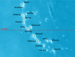
Map of South Tarawa
|
|
| Geography | |
|---|---|
| Location | Pacific Ocean |
| Coordinates | 1°26′N 173°00′E / 1.433°N 173.000°E |
| Archipelago | Gilbert Islands |
| Area | 15.76 km2 (6.08 sq mi) |
| Highest elevation | 3 m (10 ft) |
| Administration | |
|
Kiribati
|
|
| Demographics | |
| Population | 50,182 (2010 Census) |
| Pop. density | 3,184 /km2 (8,247 /sq mi) |
| Ethnic groups | I-Kiribati 98.9% |
South Tarawa (in Gilbertese Tarawa Teinainano) is the capital and hub of the Republic of Kiribati and home to approximately half of Kiribati's total population. The South Tarawa population centre consists of all the small islets from Betio in the West to Bonriki in the East, connected by the South Tarawa main road; with a population of 50,182 as of 2010[update].
South Tarawa is home to most of the Government, commercial and education facilities in Kiribati including the Port and the High Court at Betio, the State House, Government Ministries and foreign High Commissions in Bairiki, a University of the South Pacific campus in Teaorereke, the House of Assembly in Ambo, the Kiribati Teacher College and King George V and Elaine Bernachi School, the Government High School, is in Bikenibeu, and the central hospital in Nawerewere. The Roman Catholic diocese is based in Teaorereke, the Kiribati Protestant Church (Congregational) in Antebuka, and The Church of Jesus Christ of Latter-day Saints in Eita.
At the local government level, South Tarawa has two administrative subdivisions:
Buota, which is part of North Tarawa and administered by the Eutan Tarawa Council (or ETC), is linked by road to South Tarawa and is experiencing many similar issues of rapid population growth, urbanisation and environmental degradation.
South Tarawa is a string of islets between the Tarawa Lagoon to the north, with a maximum depth of 25 metres (82 ft), and the Pacific Ocean to the south, with a depth of up to 4,000 metres (13,000 ft). The island has been built from sediments from the lagoon. The process of soil accumulation is driven by the dominant easterly trade winds, and can be reversed during extended periods of westerly winds during El Niño–Southern Oscillations. All of these islets are now joined by causeways, forming one long islet on the reef along the southern side of the Tarawa Lagoon. Most of South Tarawa is less than 3 metres (9.8 feet) above sea level with an average width of only 450 metres (1,480 feet).
...
Wikipedia

