South Swindon (UK Parliament constituency)
| South Swindon | |
|---|---|
|
County constituency for the House of Commons |
|

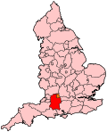
Boundary of South Swindon in Wiltshire.
|
|

Location of Wiltshire within England.
|
|
| County | Wiltshire |
| Electorate | 73,449 (December 2010) |
| Current constituency | |
| Created | 1997 |
| Member of parliament | Robert Buckland (Conservative) |
| Number of members | One |
| Created from | Swindon and Devizes |
| Overlaps | |
| European Parliament constituency | South West England |
Coordinates: 51°33′32″N 1°46′55″W / 51.559°N 1.782°W
South Swindon is a constituency represented in the House of Commons of the UK Parliament since 2010 by Robert Buckland, a Conservative.
1997-2010: The Borough of Thamesdown wards of Central, Chiseldon, Dorcan, Eastcott, Freshbrook, Lawns, Park, Ridgeway, Toothill, Walcot, and Wroughton.
2010-present: The Borough of Swindon wards of Central, Dorcan, Eastcott, Freshbrook and Grange Park, Old Town and Lawn, Parks, Ridgeway, Shaw and Nine Elms, Toothill and Westlea, Walcot, and Wroughton and Chiseldon.
The constituency was created in 1997 from parts of the seats of Swindon that was abolished, and Devizes that remains. This seat with a population of around 93,000 incorporates the southern half of the town as well as farms and villages with hamlets to the immediate south and east of Swindon.
It used slightly amended boundaries for the 2010 election, which saw it lose South Marston to North Swindon. The border now runs from Dorcan across to Bishopstone and then down to Russley Park before running west to Barbury Castle. From there it runs north to the Roughmoor area and loops back down to incorporate West Swindon, before following the railway line east through the town and back to Dorcan. In addition to the south of Swindon, main settlements include Wroughton, Chiseldon, Wanborough and Liddington.
...
Wikipedia
