South Park (Park County, Colorado)

View of South Park along U.S. Highway 285 looking eastward toward the Front Range
|
|
| Floor elevation | 10,000 feet (3,000 m) |
|---|---|
| Area | 1,000 square miles (2,600 km2) |
| Geography | |
| Coordinates | 38°58′04″N 106°02′43″W / 38.9679°N 106.04517°WCoordinates: 38°58′04″N 106°02′43″W / 38.9679°N 106.04517°W |
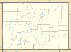
South Park is a grassland flat within the basin formed by the Rocky Mountains' Mosquito and Park Mountain Ranges at approximately 10,000 ft (3,000 m) in elevation within central Colorado. It encompasses approximately 1,000 square miles (2,590 km² or 640,000 acres) around the headwaters of the South Platte River in Park County approximately 60 mi (100 km) southwest of Denver. It is the largest and southernmost of three similarly named high altitude basins in the Front Range of Colorado, the others being North Park and Middle Park. The largest town in the basin is Fairplay, with a population of 681.
Geologically, the valley is a wide faulted syncline of sedimentary rocks, sitting between the predominantly Precambrian igneous rocks of the Front Range to the east and the Sawatch Uplift to the west. The Mosquito Range forms a high barrier along the western side of the valley. The long-extinct Thirty-Nine Mile volcanic field is located just to the southeast.
The valley is mostly underlain by Paleozoic and Mesozoic sedimentary rocks concealed by a thin layer of gravel laid down by glaciation during time. The underlying rocks are dipping slightly to the east. The eastern (and newer) side of the valley is underlain primarily by Pierre Shale laid down during Cretaceous time. The western (and older) side of the valley, on the west side of Red Hill, is underlain primarily by Permian and Pennsylvanian rocks. Red Hill runs through the center of the valley as a hogback ridge of tilted Cretaceous and Jurassic sedimentary rocks.
...
Wikipedia

