South Kalimantan
|
South Kalimantan Kalimantan Selatan کاليمانتان سلاتن |
|||||||||
|---|---|---|---|---|---|---|---|---|---|
| Province | |||||||||
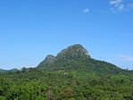
From top, left to right : Pulau Kembang, Floating market in Banjarmasin, Loksado Hill, Martapura River, Proclamation Monument, Tanjung Dewa, Mount Halau-Halau
|
|||||||||
|
|||||||||
| Motto: Haram Manyarah Waja Sampai Kaputing (Banjarese) (Never Surrender, Strong As Steel Until The End) |
|||||||||
 Location of South Kalimantan in Indonesia |
|||||||||
| Coordinates: 2°30′S 115°30′E / 2.500°S 115.500°ECoordinates: 2°30′S 115°30′E / 2.500°S 115.500°E | |||||||||
| Country |
|
||||||||
| Established | August 14, 1950 | ||||||||
| Capital |
|
||||||||
| Government | |||||||||
| • Body | South Kalimantan Regional Government | ||||||||
| • Governor | H. Sahbirin Noor | ||||||||
| • Vice Governor | Rudy Resnawan | ||||||||
| Area | |||||||||
| • Total | 38,744.23 km2 (14,959.23 sq mi) | ||||||||
| Area rank | 19th | ||||||||
| Highest elevation | 1,901 m (6,237 ft) | ||||||||
| Population (2014) | |||||||||
| • Total | 3,913,908 | ||||||||
| • Rank | 17th | ||||||||
| • Density | 100/km2 (260/sq mi) | ||||||||
| Demographics | |||||||||
| • Ethnic groups | Banjarese (76%), Javanese (13%) | ||||||||
| • Languages | Indonesian (official), Banjarese | ||||||||
| Time zone | Indonesia Central Time (UTC+8) | ||||||||
| Postcodes | 70xxx, 71xxx, 72xxx | ||||||||
| Area codes | (62)5xx | ||||||||
| ISO 3166 code | ID-KS | ||||||||
| Vehicle sign | DA | ||||||||
| HDI |
|
||||||||
| HDI rank | 21st (2014) | ||||||||
| Largest city by area | Banjarbaru - 371.00 square kilometres (143.24 sq mi) | ||||||||
| Largest city by population | Banjarmasin - (625,481 - 2010) | ||||||||
| Largest regency by area | Kotabaru Regency - 9,482.73 square kilometres (3,661.30 sq mi) | ||||||||
| Largest regency by population | Banjar Regency - (506,839 - 2010) | ||||||||
| Website | Government official site | ||||||||
| = | |||||||||
South Kalimantan (Indonesian: Kalimantan Selatan, Jawi: کاليمانتان سلاتن) is a province of Indonesia. It is located in Kalimantan, the Indonesian territory of Borneo. The provincial capital is Banjarmasin. The population of South Kalimantan was recorded at just over 3.625 million people at the 2010 Census; the latest official estimate (for January 2014) is 3,913,908.
One of five Indonesian provinces in Kalimantan, it is bordered by the Makassar Strait in the east, Central Kalimantan in the west and north, the Java Sea in the south, and East Kalimantan in the north.
South Kalimantan Province with Banjarmasin city as capital consists of 11 regencies and 2 cities is geographically located between 114° 19’ 13’’ - 116° 33’ 28’’ East Longitude and 1° 21’ 49’’ - 4° 10’ 14’’ South Longitude. Based on the location, South Kalimantan Province area only 6.98% of Kalimantan Island overall, which is 37.530,52 km2 with boundaries as follows:
In terms of topography, South Kalimantan province consists of 4 parts, alluvial land, swamps land, hills and mountains. Land inclination with 4 class classification showed that 43.31% of South Kalimantan province has 0-2% land inclination.
The extensive details according to land inclination are as follows:
The area of South Kalimantan province according to altitude classes are divided into 6 altitude classes indicate the area of South Kalimantan Province mostly located at altitude class > 25–100 m above sea level, ie 31.09%.
South Kalimantan province area flowed by many rivers. The rivers include Barito, Riam Kanan, Riam Kiwa, Balangan, Batang Alai, Amandit, Tapin, Kintap, Batulicin, Sampanahan, etc. Generally, these rivers originate from Meratus mountain and empties to Java Sea and Makassar Strait.
The annual rainfall intensity is high, ranging between 2,000 and 3,700 mm. The mean number of rainy days per year is 120. Barito is the main river, used as a transportation route to the northern part of the province and to Central Kalimantan. Other smaller rivers are mostly springing from the Meratus Mountains.
...
Wikipedia


