Sonoita
| Sonoita, Arizona | |
|---|---|
| Census-designated place | |

Sonoita, as seen from the main intersection in town.
|
|
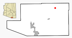
 Location in Santa Cruz County and the state of Arizona |
|
| Coordinates: 31°40′8″N 110°39′14″W / 31.66889°N 110.65389°WCoordinates: 31°40′8″N 110°39′14″W / 31.66889°N 110.65389°W | |
| Country | United States |
| State | Arizona |
| County | Santa Cruz |
| Area | |
| • Total | 10.56 sq mi (27.34 km2) |
| • Land | 10.55 sq mi (27.33 km2) |
| • Water | 0.01 sq mi (0.01 km2) |
| Elevation | 4,885 ft (1,489 m) |
| Population (2010) | |
| • Total | 14,287 |
| • Estimate (2016) | N/A |
| Time zone | MST (no DST) (UTC-7) |
| ZIP code | 85637 |
| Area code(s) | 520 |
| FIPS code | 04-68220 |
| GNIS feature ID | 0034635 |
Sonoita (O'odham: Ṣon ʼOidag) is a census-designated place (CDP) in Santa Cruz County, Arizona, United States. The population was 818 at the 2010 census.
The origin of the name of the CDP is the O'odham Ṣon ʼOidag, which may be best translated as "spring field". (There are several places that the O'odham call Ṣon ʼOidag within 200 km of this place, all agricultural spots.) Sonoita has for many years been a popular place for wealthy Arizonans to establish vacation and retirement homes and ranches. Sonoita is experiencing significant growth.
Sonoita is located at 31°40′8″N 110°39′14″W / 31.66889°N 110.65389°W (31.668862, -110.653964).
According to the United States Census Bureau, the CDP has a total area of 10.5 square miles (27.3 km2), all of it land.
As of the census of 2000, there were 826 people, 358 households, and 264 families residing in the CDP. The population density was 18.1 people per square mile (7.0/km²). There were 401 housing units at an average density of 8.8 per square mile (3.4/km²). The racial makeup of the CDP was 89.59% White, 0.48% Black or African American, 0.48% Native American, 0.12% Asian, 0.24% Pacific Islander, 6.54% from other races, and 2.54% from two or more races. 16.71% of the population were Hispanic or Latino of any race.
...
Wikipedia
