Somerset, Kentucky
| Somerset, Kentucky | |
|---|---|
| City | |

Corner of Main Street and West Columbia Street, featuring the historic Goldenburg Furniture building, now fronted by The Square Restaurant and Lounge
|
|
| Motto: Welcome Home | |
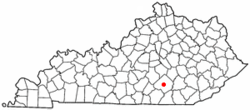
 Location of Somerset, Kentucky |
|
| Coordinates: 37°4′59″N 84°36′34″W / 37.08306°N 84.60944°WCoordinates: 37°4′59″N 84°36′34″W / 37.08306°N 84.60944°W | |
| Country | United States |
| State | Kentucky |
| County | Pulaski |
| Government | |
| • Mayor | Eddie Girdler |
| Area | |
| • Total | 11.3 sq mi (29.2 km2) |
| • Land | 11.3 sq mi (29.2 km2) |
| • Water | 0.0 sq mi (0.0 km2) |
| Elevation | 971 ft (296 m) |
| Population (2010) | |
| • Total | 11,196 |
| • Density | 990.8/sq mi (383.4/km2) |
| Time zone | Eastern (EST) (UTC-5) |
| • Summer (DST) | EDT (UTC-4) |
| ZIP codes | 42500-42599 |
| Area code(s) | 606 |
| FIPS code | 21-71688 |
| GNIS feature ID | 0503873 |
| Website | http://www.cityofsomerset.com/ |
Somerset is a home rule-class city in Pulaski County, Kentucky, United States. The city population was 11,196 according to the 2010 census.
Somerset was first settled in 1798 by Thomas Hansford and received its name from Somerset County, New Jersey, where some of the early settlers had formerly lived. Somerset became the Pulaski County seat in 1802, and it was incorporated as a city in 1887. A significant Civil War battle was fought in January 1862, at Mill Springs (now "Nancy") about 8 miles (13 km) west of Somerset, and a museum is at the site. A smaller battle was fought nearby at Dutton's Hill in 1863. The completion of Lake Cumberland in 1950 transformed Somerset from a sleepy rural community into one of the largest recreation centers in Kentucky, drawing more than 1.7 million visitors annually, especially between the Memorial and Labor Day holidays.
Somerset is located at 37°4′59″N 84°36′34″W / 37.08306°N 84.60944°W (37.082966, -84.609387), and the downtown (central) part of the city is at an elevation of around 750–800 feet above sea level. The city is located at the eastern end of Kentucky's Mississippian Plateau (or Pennyroyal Plateau); however, the micropolitan area extends eastward into the Appalachian Plateau (or Eastern Kentucky Coalfield), and northward to Kentucky's Outer Bluegrass region. Thus, the area shows significant variations in landforms and scenery.
...
Wikipedia
