Snowtown
|
Snowtown South Australia |
|||||||||||||||
|---|---|---|---|---|---|---|---|---|---|---|---|---|---|---|---|

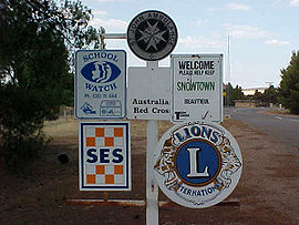
South-western entrance to Snowtown
|
|||||||||||||||
| Coordinates | 33°47′0″S 138°12′0″E / 33.78333°S 138.20000°ECoordinates: 33°47′0″S 138°12′0″E / 33.78333°S 138.20000°E | ||||||||||||||
| Population | 405 (2006 census) | ||||||||||||||
| Established | 1878 | ||||||||||||||
| Postcode(s) | 5520 | ||||||||||||||
| Elevation | 103 m (338 ft) | ||||||||||||||
| Location | 145 km (90 mi) north of Adelaide | ||||||||||||||
| LGA(s) | Wakefield Regional Council | ||||||||||||||
| State electorate(s) | Frome | ||||||||||||||
| Federal Division(s) | Grey | ||||||||||||||
|
|||||||||||||||
|
|||||||||||||||
Snowtown is a town located in the Mid North of South Australia 145 km (90 miles) north of Adelaide and lies on the main road and rail routes between Adelaide and Perth — the Augusta Highway and Adelaide-Port Augusta railway line. The town's elevation is 103 metres (338 feet) and on average the town receives 389 mm of rainfall per annum.
The settlement of Snowtown by non-indigenous Australians initially grew up around a railway station on the Brinkworth-Wallaroo line. Located on what was traditionally the land of the Kaurna (indigenous) people, the first pioneers arrived sometime between 1867 and 1869 due to the rapid expansion of farming to the north of the area. During this period one of the first major structures, the old Snowtown Pub was built in 1868.Bailliere's South Australian gazetteer and road guide, published in 1866, contains a brief description of "Hummock's Run" located 28 miles (45 km) north of Port Wakefield. This farmland, according to the publication, contained the farming stations of Barunga, Bumbunga and Wokurna and consisted of "salt lakes and lagoons, dense scrub, with mallee, pine and bushes, grassy plains and saltbush, well grassed spurs and hills, with oaks and wattle on the Broughton River."
The Government only started showing interest in the settlement as late as 1869 when it planned to establish various new towns throughout the district and to divide the land into much smaller holdings. Snowtown's charter as a government town was proclaimed on 19 December 1878 by Governor William Jervois. Jervois named the town after one of the members of the Snow family who were his cousins and lived on Yorke Peninsula (which lies immediately west and southwest of Snowtown). It is officially considered that the town was named after Thomas Snow, who became Jervois's aide de camp when he received his posting in South Australia. The town boundaries were defined as an approximate rectangle immediately adjacent to section 114 in the Hundred of Barunga north east of Barunga Creek, north west of Salt Lagoon and south of Boundary Creek.
...
Wikipedia

