Smolan, Kansas
| Smolan, Kansas | |
|---|---|
| City | |
 Location within Saline County and Kansas |
|
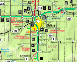
 KDOT map of Saline County (legend) |
|
| Coordinates: 38°44′17″N 97°41′2″W / 38.73806°N 97.68389°WCoordinates: 38°44′17″N 97°41′2″W / 38.73806°N 97.68389°W | |
| Country | United States |
| State | Kansas |
| County | Saline |
| Government | |
| • Type | Mayor–Council |
| Area | |
| • Total | 0.13 sq mi (0.34 km2) |
| • Land | 0.13 sq mi (0.34 km2) |
| • Water | 0 sq mi (0 km2) |
| Elevation | 1,283 ft (391 m) |
| Population (2010) | |
| • Total | 215 |
| • Estimate (2015) | 214 |
| • Density | 1,700/sq mi (630/km2) |
| Time zone | Central (CST) (UTC-6) |
| • Summer (DST) | CDT (UTC-5) |
| ZIP Code | 67479 |
| FIPS code | 20-66100 |
| GNIS feature ID | 0476947 |
Smolan is a city in Saline County, Kansas, United States. As of the 2010 census, the city population was 215.
Smolan was named after the Swedish province of Småland, the native home of a large share of the early settlers.
A post office was opened in Smolan in 1887, and remained in operation until it was discontinued in 1997.
Smolan is located at 38°44′17″N 97°41′2″W / 38.73806°N 97.68389°W (38.738009, -97.683940). According to the United States Census Bureau, the city has a total area of 0.13 square miles (0.34 km2), all of it land.
It is part of the Salina Micropolitan Statistical Area.
As of the census of 2010, there were 215 people, 80 households, and 59 families residing in the city. The population density was 1,653.8 inhabitants per square mile (638.5/km2). There were 94 housing units at an average density of 723.1 per square mile (279.2/km2). The racial makeup of the city was 91.2% White, 3.7% Asian, 2.8% from other races, and 2.3% from two or more races. Hispanic or Latino of any race were 4.7% of the population.
...
Wikipedia
