Smith Creek (Santa Clara County, California)
| Smith Creek | |
| stream | |
|
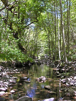
View upstream of Smith Creek at Mt. Hamilton Road crossing with California bay laurel and white alder, courtesy of Robert A. Leidy PhD, U.S. EPA
|
|
| Country | United States |
|---|---|
| State | California |
| Region | Santa Clara County |
| Tributaries | |
| - right | Castle Canyon, Sulphur Creek |
| Source | Northwestern slope of Bollinger Ridge in the Diablo Range |
| - elevation | 3,520 ft (1,073 m) |
| - coordinates | 37°16′39″N 121°33′41″W / 37.27750°N 121.56139°W |
| Mouth | Confluence with Isabel Creek to form source of Arroyo Hondo |
| - elevation | 1,585 ft (483 m) |
| - coordinates | 37°23′00″N 121°41′34″W / 37.38333°N 121.69278°WCoordinates: 37°23′00″N 121°41′34″W / 37.38333°N 121.69278°W |
Smith Creek is a 14-mile-long (23 km)perennial stream which flows along the western flank of Mount Hamilton in Santa Clara County. The creek begins near Bollinger Ridge, about 7.7 km SxSW of Mount Hamilton.
Some of the early recorded history of the Smith Creek watershed is associated with the pioneer family of the Winsors.
Where Mt. Hamilton Road crosses Smith Creek, there used to be the Hotel Santa Ysabel.
Smith Creek arises at 3,520 feet (1,070 m) then flows westerly through Horse Valley, then turns northwest. It receives Sulphur Creek 0.8 miles (1.3 km) before crossing Mount Hamilton Road about 12.7 km west of Mount Hamilton (the Smith Creek Ranger Station/CAL FIRE is located at this crossing at 22805 Mt. Hamilton Road). The creek continues northwest along the eastern boundary of Joseph D. Grant County Park and joins Isabel Creek about 15.3 km WNW of Mount Hamilton at 37°23′00″N 121°41′34″W / 37.38333°N 121.69278°W, forming Arroyo Hondo and eventually joining Calaveras Creek in Calaveras Reservoir. Calaveras Creek exits the reservoir and joins Alameda Creek before final terminating in San Francisco Bay.
...
Wikipedia

