Slavkovský štít
| Slavkovský štít | |
|---|---|

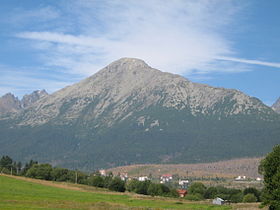
Slavkovský štít viewed from Nová Lesná
|
|
| Highest point | |
| Elevation | 2,452 m (8,045 ft) |
| Coordinates | 49°10′N 20°11′E / 49.167°N 20.183°ECoordinates: 49°10′N 20°11′E / 49.167°N 20.183°E |
| Geography | |
| Location | Tatra National Park, Poprad, Prešov, Slovakia |
| Parent range | High Tatras |
| Geology | |
| Mountain type | granite |
Slavkovský štít is the fourth highest mountain peak in the High Tatra mountains in Slovakia. Its summit is 2452 metres above sea level. It can be reached by foot on a walking trail in about four and a half hours from Starý Smokovec. The first recorded ascent was by Juraj Buchholtz in 1664.
...
Wikipedia

