Skellefteå Airport
|
Skellefteå Airport Skellefteå flygplats |
|||||||||||
|---|---|---|---|---|---|---|---|---|---|---|---|
 |
|||||||||||
 |
|||||||||||
| Summary | |||||||||||
| Airport type | Public | ||||||||||
| Operator | Skellefteå Municipality | ||||||||||
| Serves | Skellefteå, Sweden | ||||||||||
| Elevation AMSL | 157 ft / 48 m | ||||||||||
| Coordinates | 64°37′29″N 21°04′37″E / 64.62472°N 21.07694°ECoordinates: 64°37′29″N 21°04′37″E / 64.62472°N 21.07694°E | ||||||||||
| Website | skellefteaairport.se | ||||||||||
| Map | |||||||||||
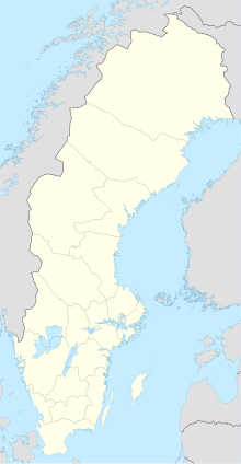
| Location within Sweden | |||||||||||
| Runways | |||||||||||
|
|||||||||||
| Statistics (2016) | |||||||||||
|
|||||||||||
|
Statistics: Swedish Transport Agency
|
|||||||||||
| Passengers total | 280,926 |
|---|---|
| International passengers | 15,592 |
| Domestic passengers | 265,334 |
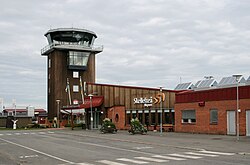
Skellefteå Airport (IATA: SFT, ICAO: ESNS), is located about 17 km from Skellefteå, Västerbotten, Sweden.
Skellefteå Airport is ranked as one of 10 largest airports in Sweden in terms of domestic flights.
Just before the Easter in March 2016, the airport gained notability for issuing a warning to witches flying south to Blockula during the holiday, not to enter the airport's airspace since they risked colliding with aircraft. Instructions for witches on how to submit proper flight plans were included in the warning. According to old Swedish folklore, witches (påskkärringar) fly on their broomstick to Blockula during Easter, accompanied by their familiars, usually cats. Metrologist Åsa Rasmussen added a recommendation to let the cat stay at home, since the weather forecast predicted heavy snowfall.
...
Wikipedia

