Sistema Ox Bel Ha
| Sistema Ox Bel Ha | |
|---|---|
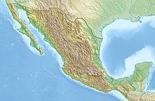
| Location | Quintana Roo, Mexico |
| Coordinates | 20°9′37″N 87°29′15″W / 20.16028°N 87.48750°WCoordinates: 20°9′37″N 87°29′15″W / 20.16028°N 87.48750°W |
| Depth | 57.3 m (188 ft) |
| Length | 270.17 km (167.88 mi) |
| Discovery | February 1996 |
| Geology | Limestone |
| Entrances | 143 Cenotes |
| Difficulty | Advanced cave diving |
| Cave survey | Grupo de Exploración Ox Bel Ha |
Sistema Ox Bel Ha (from Mayan meaning "Three Paths of Water"; short Ox Bel Ha) is a cave system in Quintana Roo, Mexico. It is the longest explored underwater cave in the world and ranks fourth including dry caves. As of May 2017 the surveyed length is 270.2 kilometers (167.9 mi) of underwater passages.
...
Wikipedia

