Siskiyou County, California
| Siskiyou County, California | |||||
|---|---|---|---|---|---|
| County | |||||
| County of Siskiyou | |||||
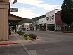
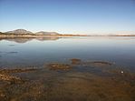
Images, from top down, left to right: Mount Shasta, the historic West Miner Street in Yreka, Indian Tom Lake
|
|||||
|
|||||
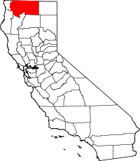
 Location in the U.S. state of California |
|||||
 California's location in the United States |
|||||
| Coordinates: 41°35′N 122°30′W / 41.583°N 122.500°WCoordinates: 41°35′N 122°30′W / 41.583°N 122.500°W | |||||
| Country | |||||
| State |
|
||||
| Region | Shasta Cascade | ||||
| Incorporated | 1852 | ||||
| County seat | Yreka | ||||
| Largest city | Yreka | ||||
| Area | |||||
| • Total | 16,440 km2 (6,347 sq mi) | ||||
| • Land | 16,260 km2 (6,278 sq mi) | ||||
| • Water | 180 km2 (69 sq mi) | ||||
| Highest elevation | 4,317 m (14,162 ft) | ||||
| Population (April 1, 2010) | |||||
| • Total | 44,900 | ||||
| • Estimate (2015) | 43,554 | ||||
| • Density | 2.7/km2 (7.1/sq mi) | ||||
| Time zone | Pacific Time Zone (UTC-8) | ||||
| • Summer (DST) | Pacific Daylight Time (UTC-7) | ||||
| Area code | 530 | ||||
| FIPS code | 06-093 | ||||
| GNIS feature ID | 277311 | ||||
| Website | www |
||||
Siskiyou County /ˈsɪskjuː/ SISS-kew is a county in the northernmost part of the U.S. state of California. As of the 2010 census, the population was 44,900. Its county seat is Yreka.
Siskiyou County is in the Shasta Cascade region along the Oregon border. Because of its outdoor recreation opportunities and Gold Rush era history, it is an important tourist destination within the state.
Siskiyou County was created on March 22, 1852, from parts of Shasta and Klamath Counties, and named after the Siskiyou mountain range. Parts of the county's territory were given to Modoc County in 1855.
The county is the site of the central section of the Siskiyou Trail, which ran between California's Central Valley and the Pacific Northwest. The Siskiyou Trail followed Native American footpaths, and was extended by Hudson's Bay Company trappers in the 1830s. Its length was increased by "Forty-Niners" during the California Gold Rush.
...
Wikipedia


