Sinn (Hesse)
| Sinn | ||
|---|---|---|
|
||
| Coordinates: 50°39′N 08°20′E / 50.650°N 8.333°ECoordinates: 50°39′N 08°20′E / 50.650°N 8.333°E | ||
| Country | Germany | |
| State | Hesse | |
| Admin. region | Gießen | |
| District | Lahn-Dill-Kreis | |
| Government | ||
| • Mayor | Hans Werner Bender | |
| Area | ||
| • Total | 18.73 km2 (7.23 sq mi) | |
| Elevation | 241 m (791 ft) | |
| Population (2015-12-31) | ||
| • Total | 6,443 | |
| • Density | 340/km2 (890/sq mi) | |
| Time zone | CET/CEST (UTC+1/+2) | |
| Postal codes | 35764 | |
| Dialling codes | 02772 | |
| Vehicle registration | LDK, DIL | |
| Website | www.gemeindesinn.de | |
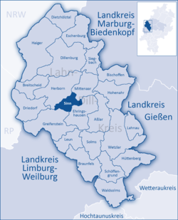
Sinn is a community in Middle Hesse, Germany, in the Lahn-Dill-Kreis.
Sinn lies at a height of 185 to 356 m (607 to 1,168 ft) above sea level at the foot of the Westerwald range, 3 km (1.9 mi) south of Herborn in the Dill valley.
Edingen lies on the Dill valley's west side on the slopes of the Westerwald range below the Greifenstein ruins and the like-named constituent community in the community of Greifenstein.
Sinn borders in the northeast on the community of Mittenaar, in the east on the community of Ehringshausen, in the south on the community of Greifenstein and in the northwest on the town of Herborn (all in the Lahn-Dill-Kreis).
The community consists of the following centres:
The Dill valley's fertile slopes and dales were settled quite early on. Archaeological finds in the countryside around Edingen range through all epochs and have led to the conclusion that the area has been permanently settled since the 4th century BC. Documents confirm all three constituent communities' existence since the 13th century.
Edingen and Fleisbach were shaped by agriculture and clung to this structure until the middle of the 20th century. Sinn was nevertheless caught up in the Industrial Revolution in the mid 19th century. Encouraged by the mining in the Sieg-Dill area, an ironworks came to town and set up shop, soon followed by foundries and metalworking businesses.
The site is believed to have been settled by early Germanic times, as witnessed by finds from the 4th century BC, and the name is also a clue to this.
The first documentary mention in 1341 refers to the "Edinger Hof", said to be a place around which settlement was crystallizing. In the documents transferring ownership to the Counts of Nassau-Dillenburg, the place is named as "Ödingen". In 1629, the Edinger Hof passed by division of inheritance to the House of Solm-Greifenstein and in 1851 to the community of Edingen, which sold the Hof again to three private citizens in 1921.
...
Wikipedia


