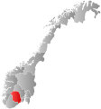
Siljan, Norway
| Siljan kommune | |||
|---|---|---|---|
| Municipality | |||
|
|||
 Siljan within Telemark |
|||
| Coordinates: 59°17′51″N 9°42′23″E / 59.29750°N 9.70639°ECoordinates: 59°17′51″N 9°42′23″E / 59.29750°N 9.70639°E | |||
| Country | Norway | ||
| County | Telemark | ||
| District | Grenland | ||
| Administrative centre | Siljan | ||
| Government | |||
| • Mayor (2007) | Ole Kristian Holtan (Ap) | ||
| Area | |||
| • Total | 214 km2 (83 sq mi) | ||
| • Land | 202 km2 (78 sq mi) | ||
| Area rank | 324 in Norway | ||
| Population (2004) | |||
| • Total | 2,349 | ||
| • Rank | 314 in Norway | ||
| • Density | 12/km2 (30/sq mi) | ||
| • Change (10 years) | 3.1 % | ||
| Time zone | CET (UTC+1) | ||
| • Summer (DST) | CEST (UTC+2) | ||
| ISO 3166 code | NO-0811 | ||
| Official language form | Neutral | ||
| Website | www |
||
|
|
|||
Siljan is a municipality in Telemark county, Norway. It is part of the traditional region of Grenland. The administrative centre of the municipality is the village of Siljan. The parish of Slemdal was established as a municipality on 1 January 1838 (see formannskapsdistrikt). The name was later changed to Siljan.
The municipality is located northeast of Skien and borders Buskerud county in the north and Vestfold county in the east. There is a forest district on both sides of Skiensvassdraget (Skien river). The older main road to Skien, Larvik, and Oslo, passes through Siljan.
The municipality (originally the parish) is named after the old Siljan farm (Old Norse: Seljur), since the first church was built there. The name is (probably) the plural form of selja which means "sallow tree" or "willow". Prior to 1918, the name of the municipality was Slemdal.
The coat-of-arms is from modern times. They were granted in 1989. The arms show three white saw blades on a green background. It was chosen to represent the timber industry of the municipality.
...
Wikipedia


