Sikeston, Missouri
| Sikeston, Missouri | |
|---|---|
| City | |
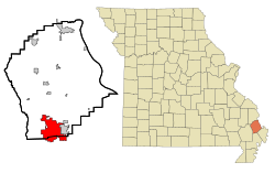
 Location of Sikeston, Missouri |
|
| Coordinates: 36°52′46″N 89°35′7″W / 36.87944°N 89.58528°WCoordinates: 36°52′46″N 89°35′7″W / 36.87944°N 89.58528°W | |
| Country | United States |
| State | Missouri |
| Counties | Scott, New Madrid |
| Government | |
| • Type | Mayor-Council |
| • Mayor | Steve Burch |
| Area | |
| • Total | 17.48 sq mi (45.27 km2) |
| • Land | 17.32 sq mi (44.86 km2) |
| • Water | 0.16 sq mi (0.41 km2) |
| Elevation | 328 ft (100 m) |
| Population (2010) | |
| • Total | 16,318 |
| • Estimate (2012) | 16,330 |
| • Density | 942.1/sq mi (363.7/km2) |
| Time zone | Central (CST) (UTC-6) |
| • Summer (DST) | CDT (UTC-5) |
| ZIP code | 63801 |
| Area code(s) | 573 |
| FIPS code | 29-67790 |
| GNIS feature ID | 0726435 |
| Website | http://www.sikeston.org/ |
Sikeston /ˈsaɪkstən/ is a city located both in southern Scott County and northern New Madrid County, in the U.S. state of Missouri. It is situated just north of the "Missouri Bootheel", although many locals consider Sikeston a part of it. By way of Interstate 55, Interstate 57, and U.S. Route 60, Sikeston is close to the halfway point between St. Louis, Missouri and Memphis, Tennessee and three hours from Nashville, Tennessee. The city is named after John Sikes, who founded it in 1860. It is the principal city of the Sikeston Micropolitan Statistical Area, which consists of all of Scott County, and has a total population of 41,143.
As of the 2010 census, the city population was 16,318, making it the fourth-most populous city in Missouri's 8th Congressional district (map) behind Cape Girardeau, Rolla, and Poplar Bluff and just ahead of Farmington. Before the 2010 census, it had been the second-most populous city in the district.
...
Wikipedia
